
| Previous Site | Next Site |
Earth Science Conservation Review
| Marlbank-Cuilcagh Mountain Region; East Cuilcagh Overview | Fermanagh |
| Site number: | 1153 | ||
| ESCC: | IC | ||
| Locality Type: | Karst | ||
| Grid Reference: | H1629 Approximate | ||
| Google maps: | 54.21016,-7.75476 | ||
| County: | Fermanagh | Council area: | Fermanagh & Omagh District Council |
| Period: | Quaternary, Carboniferous | ||
| Stages: | Asbian, Holocene, Visean | ||
| Lithostrat: | Dartry Limestone Formation, Glenade Sandstone Formation, Glencar Limestone Formation, Meenymore Formation | ||
| Site Description | |
|---|---|
 | |
| Highlights: | |
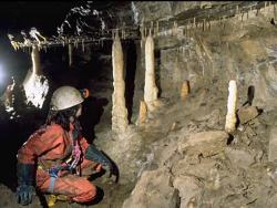
Deep potholes developed along major joints and faults in horizontally bedded cherty limestones. A wide variety of glaciokarst features and surface karst features are developed in an area of extensive upland blanket bog cover. | |
| Introduction: | |
The East Cuilcagh Karst is a N-S oriented belt of upland limestone extending from Greenan townland at its southern margin, through Gortalughany and Beihy townlands and Aghitirourke townland east of the Owenbrean River (Sheet 243). The karst hydrology of the area is complex and poorly understood and recent tracing experiments have revealed surprising results. Due to the nature of the limestones, a unique style of cave development in Northern Ireland is present, with deep joint and fault controlled potholes developed in strongly silicified, thin, horizontally bedded limestones. Cave development is generally vertical with only a relatively small amount of horizontal cave discovered to date. Due to the heavily weathered nature of much of the silicified limestones many of the shafts are blocked by collapse debris. Surface features include some well developed karren and a number of glaciokarst features including permafrost- controlled dry valleys. Major speleological sites: Polliniska (H1645 2898), Pollnatagha (H1646 2899), Peter Bryant's Bullock Hole (H1635 2918), Black Pot (H1636 2940), Pollnaclanawley (H1647 2956), Peter Bryant's Hole (H1653 2965), Pigeon Pots (H156 305), Goat Pot (H1578 3133). Minor speleological sites: Sheep Pot (H1562 3098), Badger Pot (H1554 3067), Tea Pot (H1633 2937), Long Pot (H164 292), Aghatirourke Pot (H1563 3090). Total surveyed cave: ~1km. Area of exposed limestone pavement: ~0.2km2. Catchment area: The hydrology of east Cuilcagh is, at present, largely unknown. | |
| Description: | |
I - Hydrology The hydrology of east Cuilcagh is believed to be complex and underground stream pathways are poorly understood. Research by a student from the Limestone Research Group commenced in 1995. The karst hydrological system on east Cuilcagh is fed by a large number of small sinks, those at Polliniska, Peter Bryant's', Black Pot and Pigeon Pots representing the largest. Possible - probable resurgences for the streams sinking on east Cuilcagh include Gortalughany Rising, three unnamed risings and Aghaboy rising (County Cavan). Recent tracing experiments suggest that water sinking at Goat Pot drains to Cascades Rising, and Pigeon Pots have been positively traced to Shannon Pot in County Cavan, some 15km west of the sinks (J. Gunn pers. comm.). II - Underground Karst (i) Caves associated with the Pollnatagha-Black Pot structure This series of pots are developed along a single structural trend (major joints or small faults) oriented 245°. The pots are frequently open to the surface and consist of deep vertical rift shafts separated by short horizontal passages developed in the heavily cherted limestones of the "Cherty Facies" Member. The pots are often choked at the bottom by limestone and chert debris derived from the walls of the pots and water backs up considerably in flood. Recent exploration has discovered significant amounts of tortuous horizontal passage. The main caves associated with the structure are; Peter Bryant's Hole:- Approximately 25m deep with 150m of horizontal development. Passages are all fracture controlled rifts. Calcite formations are present. 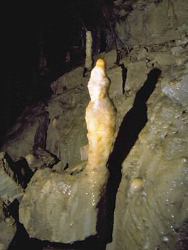 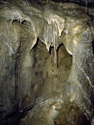 Black Pot:- Black Pot is a complex series of fracture controlled rifts and rare bedding plane passages. Total depth is estimated as 75m, with about 500m of horizontal development. Tea Pot and Long Pot:- Dolines, both with a small sinking stream and a 5m deep rift at the bottom. 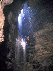 (ii) Polliniska-Pollnatagha-Pollprughlisk (The Border Pots) The Polliniska-Pollnatagha-Pollprughlisk system is a series of interconnected fracture controlled rift passages entered via a number of deep vertical pots, of which only one, Polliniska, is currently an active sink. 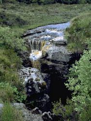 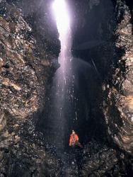 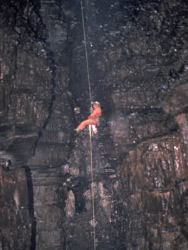 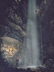 (iii) Pigeon Pots Pigeon Pots is a large fault controlled open rift oriented 070° with a series of vertical shafts developed along its length. A small stream sinks at its southern end. Underground development again consists of a series of shafts and short horizontal sections. In flood conditions the shafts backup completely. (iv) Aghatirourke Townland sites Aghatirourke Pot:- Fracture controlled 28m deep rift pothole developed in a large doline. Large breakdown pile in chamber at bottom. 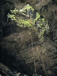 Sheep Pot:- Stream sink in small doline with a short cave close to surface. 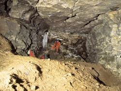 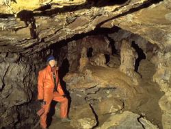 III - Surface karst (i) Karren There is little well developed surface karren exposed on east Cuilcagh, due to the extensive peat and drift cover in this area. There are, however, two areas of note; limestone pavement developed at the northeastern end of Pigeon Pots and an extensive doline field extending north from Legacurragh Gap. (ii) Pigeon Pots Pavement At the northeastern end of Pigeon Pots well developed limestone pavement is exposed over an area of approximately 1000m2. The pavement has well developed clints and grikes and is notable for the presence of mature trees which are rooted in the grikes. 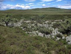 (iii) Legacurragh Doline Field An extensive doline field extends north along a lineament from the eastern end of Pigeon Pots, passing to the west and north of Legacurragh Gap. To the west of this doline field are three significant speleological sites, Badger Hole, Goat Pot and Sheep Pot. This doline field is one of the best developed and preserved fields in Northern Ireland. IV - Glaciokarst features (i) Legacurragh Gap 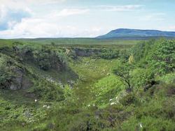 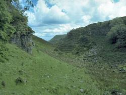 (ii) The Pound 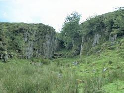 (iii) Greenan Arch 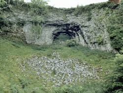 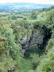 | |
| Importance: | |
Cave development: The potholes associated with the Pollnatagha-Black Pot structure are the best examples of fracture controlled vertical shaft and horizontal rift development in cherty limestones in Northern Ireland. Outside the east Cuilcagh area, there is no other extensive vertical cave development occurring within the cherty facies of the Dartry Limestone. Glaciokarst: The permafrost dry valleys are the best developed examples recorded in Northern Ireland. Legacurragh Doline Field: This doline field is one of the best developed and preserved fields in Northern Ireland. | |
| Interpretation: | |
I - Hydrology Pigeon Pots have been traced to Shannon Pot in County Cavan. Goat Pot has been traced to Cascades, probably following the trace of the Cuilcagh Dyke west and flowing north where a N-S structure offsets the Cuilcagh Dyke to the south of Pollasumera. II - Underground Karst The majority of the caves on east Cuilcagh are deep vertical rift shafts separated by short horizontal passages developed in the heavily cherted limestones of the "Cherty Facies" Member. The high silica content of the limestones has inhibited cave development and has restricted development to solution along major vertical and sub-vertical fractures. (i) Caves associated with the Pollnatagha-Black Pot structure The caves associated with the Pollnatagha-Black Pot structure are a series of vertical shafts and horizontal rifts developed along major and minor fractures related to a major fault zone developed on east Cuilcagh (the Pollnatagha-Black Pot structure). The heavily silicification and thin bedding within the "Cherty Facies" Member on east Cuilcagh has led to large scale collapse of the walls of the larger pots resulting in blockage by significant quantities of scree. Polliniska, Pollprughlisk and Pollnatagha are a well developed example of a retreating sink line of which the oldest sink lies in the Republic of Ireland. III - Surface Karst (i) Legacurragh Doline Field This is presumed to be solution doline development by diffuse input at the contact between the shaley Carn Limestone Member and the cherty facies of the Dartry Limestone Formation. IV - Glaciokarst Features (i) Legacurragh Gap and the Pound Legacurragh Gap and the Pound are interpreted as permafrost dry valleys, formed by surface streams unable to sink into perma- frosted limestones. The steep end walls are representative of abandoned waterfalls. The lack of breakdown debris in the floors of the valleys, together with the horizontal nature of the features, indicate that these features are not collapsed cave passage. (ii) Greenan Arch Greenan Arch is a natural bridge formed at the edge of the eastern scarp bounding eastern Cuilcagh Mountain. It is interpreted to have formed by surface streams draining east Cuilcagh in permafrost conditions. The arch has formed by stream capture by an open fracture adjacent to the scarp edge. | |
| Conclusions: | |
The major potholes and cave systems developed on east Cuilcagh represent a unique style of cave development in Northern Ireland. The cave systems are excellent examples of rift caves with poor horizontal development and have a stepped profile typical of joint controlled caves developed in well bedded limestones. Surface karst features are rare, being largely obscured by glacial drift and peat deposits, but those described above are particularly well developed and in an excellent state of preservation at present. There are unique glaciokarst features in the area (Legacurragh Gap, The Pound and Greenan Arch). | |
| Notes: | |
For site specific information see; Key Site 321 - Polliniska Key Site 322 - Pollnatagha Key Site 323 - Peter Bryant's Bullock Hole Key Site 324 - Black Pot Key Site 325 - Pollnaclanawley Key Site 326 - Peter Bryant's Hole Key Site 327 - Pigeon Pots Key Site 328 - Goat Pot Key Site 329 - Sheep Pot Key Site 330 - Badger Pot Key Site 331 - Tea Pot Key Site 332 - Long Pot Key Site 333 - Aghatirourke Pot. For information and reference lists on the systems and features of other karst areas within the Marlbank-Cuilcagh Mountain Region see; Key Site 1154 - Tullyhona, Brookfield and Trien Key Site 1155 - Prod's Pot - Cascades Rising Area Key Site 1156 - Marble Arch Karst Key Site 1157 - Western Marlbank. SAFETY NOTE The major cave entrances are generally well fenced although many do represent a significant danger to the unwary walker as many entrances are small and largely obscured by vegetation, but contain significant vertical drops. BIOLOGICAL INTEREST No fauna has been previously recorded from this site and no collection was made in the course of the current programme. A number of minor cave sites in the area are known to be used by badgers. | |
| Keywords | |
|---|---|
| Rocks: | Chert, Limestone |
| Structures: | bedding, fault, joints, rift |
| Geomorph: | cave, doline, dry valley, flowstone, karren, limestone pavement, pothole, sinkhole, speleothem, stalactite, stalagmite, straw, sump |
| Access | |
|---|---|
| Management: | |
Internal threats: There are no major internal threats to the East Cuilcagh pots as they are infrequently visited by cavers and are very dynamic cave systems, with frequent breakdown and only rare calcite speleothem development. Clastic deposits typically vary from cobble to boulder grade and there is little fine material which could be damaged. The small areas of calcite speleothems in the upper parts of Pollnaclanawley and Peter Bryants' Hole may be vulnerable if these caves were visited regularly (this is unlikely). External threats: Dumping of rubbish has been a problem in the past, especially in the dolines at the end of the road leading from Gortalughany Scenic Viewpoint. 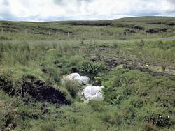 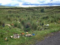 | |
| Threats: | Too many visitors; dumping. |
| Uses | |
| Potential: | Future exploration in the east Cuilcagh area will be mainly directed towards discovering extensions to the potholes associated with the Pollnatagha-Black Pot structure and in gaining entry to the underground water courses associated with Goat and Pigeon Pots. |
| References (28) | |||
|---|---|---|---|
| Adair, F., 1974. Notes on the distribution and behaviour of the cave spider, Meta menardi (Latr.) in Ireland (Araneae Argiopidae). Irish Naturalists Journal, vol. 18 pt. 2, pp.40-41. | |||
| Barnes, S., 1994. Preliminary Hydrological Investigation of the Area between Carnlough and Waterfoot, County Antrim, Northern Ireland. (Thesis) University of East Anglia. | |||
| Boon, M., 1977. Down to a Sunless Sea. | |||
| Brook, D., 1971. Notes on the Reyfad Area. University of Leeds Speleological Association Review, numb. 8. | |||
| Clark, S., 1975. Hull University Speleological Society Expedition to Northern Ireland 1975. Hull University Speleological Society. | |||
| Coleman, J., 1965. The Caves of Ireland. Anvil Books, Tralee. | |||
| Drew, D.et al., 1977. Caves and Karsts of Ireland. In 7th International Speleological Congress British Cave Research Association. | |||
| Fletcher, T.P., 1977. Lithostratigraphy of the Chalk (Ulster White Limestone Formation) in Northern Ireland. Report of the Institute of Geological Sciences, vol. 77/14. | |||
| Gunn, J., 1985. Water Tracing in the North Cuilcagh Karst. Irish Speleology, vol. 3 pt. 2. | |||
| Halliwell, R.A., 1970. An Elementary Study of the Cave Morphology and Seepage in the Reyfad-Pollnacrom System. Transactions of the Cave Research Group of Great Britain, vol. 12 numb. 4. | |||
| Hazleton, M., 1973. Irish Hypogean Fauna and Irish Biological Records 1856-1971. Transactions of the Cave Research Group of Great Britain, vol. 15 numb. 4. | |||
| Hopkirk, A., 1994. The Search for Bat Hibernacula in Ireland. The Leisler. Magazine of the Northern Ireland Bat Group, vol. 1994 numb. Spring. | |||
| Jameson, H.L., 1896. On the Exploration of the Caves of Enniskillen and Mitchelstown for the R.I.A. Flora and Fauna Committee. Irish Naturalists Journal, vol. 5, pp.93-100, plates 1. | |||
| Jones, G.Ll. & McKeever, M., 1987. Sediments and Palynology in Marble Arch Cave. Cave Science, vol. 14 numb. 1. | |||
| Kelly, J.G., 1989a. The late Chadian to Brigantian Geology of the Carrick-on-Shannon and Lough Allen Basins, North West Ireland. (Thesis) N.U.I. | |||
| Kelly, J.G., 1989b. Geology and Caves of Cuilcagh Mountain, Counties Fermanagh and Cavan. Irish Speleology, vol. 13. | |||
| Kelly, J.G., 1990. Reyfad Pot. Irelands Deepest (and Longest?) Descent 96. | |||
| Kelly, J.G., 1995. The Asbian Geology of Cuilcagh Mountain Area, Co's Fermanagh and Cavan, Ireland. Initiation, growth and decline of a tectonically controlled carbonate ramp. In European Dinantian Environments II. | |||
| Legg, I.C., Johnston, T.P., Mitchell, W.I. & Smith, R.A., 1995. Geology of the country around Derrygonelly and Marble Arch. Memoirs of the Geological Survey Northern Ireland, vol. Sheet 44,56,43. | |||
| Magennis, P., 1874. The Ribbon Informer. A Tale of Lough Erne. Frederick Bell and Co. | |||
| Martel, E.A., 1897. Irelande et Cavernes Anglaises. Libraire ch. Delagrave., Paris. | |||
| McKay, S., 1987. The Chemical Differentiation of Carbonate Aquifers in the Karst of North-West Ireland, with a view to predicting the type and length of cave system under Belmore Mountain. (Thesis) University of Bristol. | |||
| McKay, S., 1989. A study of Carbonate Aquifers in the Karst of North West Ireland. Irish Speleology, vol. 13. | |||
| Mitchell, W.I., 1983. High grade Dolomite deposits in the Belcoo - Boho area of County Fermanagh. (Unpublished Report) Geological Survey of Northern Ireland Open File Reports, vol. 68. | |||
| Nichols, A., 1970. Cambridge University Caving Club Expedition to Ireland, 1970. Cambridge University Caving Club. | |||
| Oswald, D.H., 1955. The Carboniferous Rocks between the Ox Mountains and Donegal Bay. Journal of the Geological Society of London, vol. 111, pp.167-186. | |||
| Sheridan, D.J.R., 1972. Upper Old Red Sandstone and Lower Carboniferous of the Slieve Beagh Syncline and its setting in the northwest Carboniferous basin, Ireland. Special Papers of the Geological Survey of Ireland, vol. 2, pp.1-120. | |||
| Williams, P.W., 1970. Limestone morphology in Ireland. In Irish Geographical Studies, pp.105-124 Queens University of Belfast. | |||
| Map(s): | The following areas have been marked on OSNI 1:10,000 sheets 243 and 244; EC1. Caves associated with the Pollnatagha - Black Pot structure. EC2. Exposed limestone pavement at Pigeon Pots, Pigeon Pots, Legacurragh Gap, Legacurragh Gap doline field, Badger Pot, Sheep Pot and Goat Pot. EC3. Greenan Arch and The Pound | ||
| Record type: | ESCR report | ||
| Entered by: | E M Porter | ||
| Last updated: | 23 Dec 2003 | ||
| Enlander, I., Dempster, M. & Doughty, P., 2026. Marlbank-Cuilcagh Mountain Region; East Cuilcagh Overview, County Fermanagh, site details. [In] Earth Science Conservation Review. https://www.habitas.org.uk/escr/site.php?item=1153. Accessed on 2026-11-06. |
| Previous Site | Next Site |