
| Previous Site | Next Site |
Earth Science Conservation Review
| Marlbank-Cuilcagh Mountain Region; Tullyhona, Brookfield and Trien | Fermanagh |
| Site number: | 1154 | ||
| ESCC: | IC | ||
| Locality Type: | Karst | Status: | ASSI |
| Grid Reference: | H1533 Approximate | ||
| Google maps: | 54.24613,-7.76988 | ||
| County: | Fermanagh | Council area: | Fermanagh & Omagh District Council |
| Period: | Quaternary, Carboniferous | ||
| Stages: | Asbian, Holocene, Visean | ||
| Lithostrat: | Dartry Limestone Formation, Glenade Sandstone Formation, Glencar Limestone Formation, Knockmore Limestone Member | ||
| Site Description | |
|---|---|
 | |
| Highlights: | |
Tullyhona Rising Cave is a dendritic river cave system completely formed within one carbonate mudbank "stack". Features present within the system include well developed speleothems, perched active sumps, fracture and bedding passage control, partial dolomitization along faults, roof collapse along shale bands and abandoned stream passages. The cave and surface karst are, at present, in a very good state of preservation. | |
| Introduction: | |
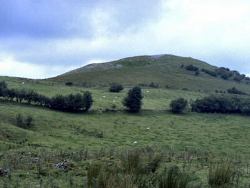
The Tullyhona Karst is located within parts of Brookfield, Tullyhona, Trien and Deer Park townlands, located at the eastern end of the Marlbank area. Topography is dominated by carbonate mudbank "knoll" topography. The area hosts one major cave system, Tullyhona Rising Cave, and its associated sites. There are a number of minor speleological sites which may be associated with Tullyhona Rising Cave. Surface karst features, such as dolines, sinks and karren, are well developed. The area totals approximately 1.25 sq km. History of Exploration: The entrance squeeze was passed by the CPC, and later a combined CPG-ISA group in the summer of 1968. The Farr Country, Up The Junction and Oxbow Inlet were discovered in 1972 by M. Farr (CDG) who successfully passed the sump by diving. The dry bypass (Fenian Terror Bypass) to the sump was discovered by the Reyfad Group in 1974, the initial attempt by E. Devoy having failed, it was subsequently passed by G. Ll. Jones and H. Ball. Major speleological sites: Tullyhona Rising Cave (H1533 3373) (1500m+ long, 65m deep), Dick's Sinks (H1503 3335), Whiskey Holes (H1545 3332) and (H1554 3332). Minor speleological sites: Tullyhona Rock Pots (H152 333), Brookfield Sink No.1 (H1458 3339). Total surveyed cave: 1500m+. Area of exposed limestone pavement: ~400m2. Catchment area: 1.5-2km2. | |
| Description: | |
I - Hydrology The main point input to Tullyhona Rising Cave is derived from two streams draining the northern slopes of Trien Mountain. These streams sink in two distinct groups of sinkholes; Dick's Sinks to the east which feed the stream in Up The Junction Passage and Whiskey Holes to the west which feed the stream in Oxbow Inlet Series. Several small inlets are encountered in the cave and these may represent small autogenic streams on the surface or accumulated allogenic input. The two streams meet at the Junction to form the Main Stream which resurges at Tullyhona Rising. II - Underground Karst The main underground karst feature in the Tullyhona area is Tullyhona Rising Cave. Tullyhona Rising and the cave entrance are located at the head of a small stream which rises at the Glencar - Dartry Limestone contact in Tullyhona townland. The main streams feeding the stream in Tullyhona Rising Cave sink at Dick's Sinks and Whiskey Holes. 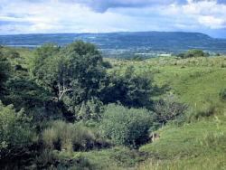 From the Junction the stream flows through The Farr Country, 150m of magnificent passage consisting of 5m square passage with a number of larger chambers and a 25m long duck towards the upstream end of the passage. At the end of The Farr Country the passage trends sharply E-W. The stream flows north after 25m, cutting down to Sump 1. The E-W passage continues at high level to Crystal Crunch, a 2m wide phreatic tube with a wide vadose slot in the floor of the passage. 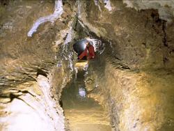 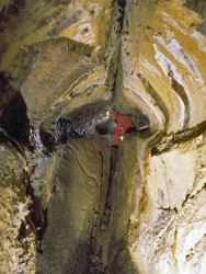 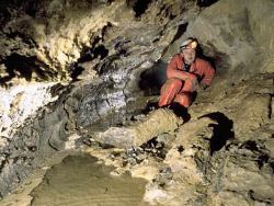 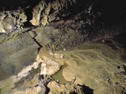 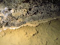 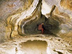 Sump 1 is 3.5m deep and 9m long and forms a U-bend in section. The stream emerges from Sump 1 at the head of a 4m high waterfall, forming a perched sump. 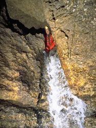 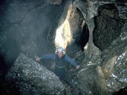 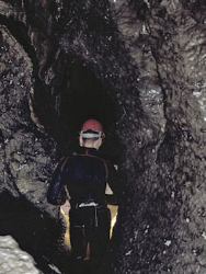 From the Fenian Terror - stream passage junction, the stream flows through a series of strongly joint controlled passages, initially with deep water and then steeply descending vadose passages with a number of cascades. There are no clastic sediments in this area of the cave. The passage shape changes dramatically at The Ducks, becoming wide and low, rather than high and narrow. 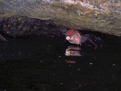 From the Boulder Chamber the stream passage consists of approximately 2m by 2m passages with abundant breakdown blocks of mudbank limestones obstructing the passage. Close to the cave entrance the passage exposes the Dartry Limestone - Glencar Limestone contact in the passage floor. 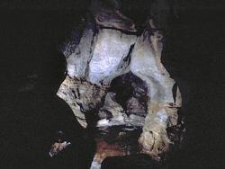 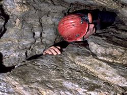 Calcite speleothems are particularly abundant in The Farr Country but are rare in Tullyhona 1, Up The Junction and the Oxbow Inlet. Coarse clastic stream deposits are well developed in Up The Junction and The Oxbow Inlet. 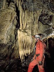 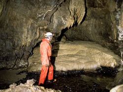 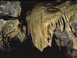 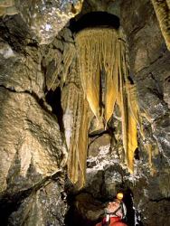 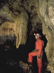 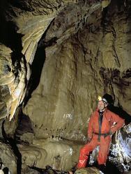 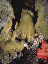 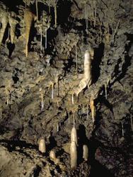 III - Surface karst Limestone pavement is well developed on the surface of the limestone knolls formed by the carbonate mudbank topography. 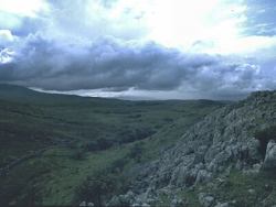 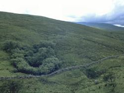 | |
| Importance: | |
The Tullyhona Karst and its associated surface and underground features are, at present, in a very good state of preservation. The cave system illustrates many classic features of speleogenesis including joint and fracture control, shale bed control, vadose downcutting, stream diversion and passage abandonment (probably due to valley floor deepening) and differential solution associated with dolomitization along faults. Calcite speleothems are particularly well developed in the Farr Country. The perched sump is one of the few, and best, examples of this feature in Northern Ireland. | |
| Interpretation: | |
I - Hydrology The hydrology of the Tullyhona area appears to be relatively simple, with larger streams sinking into larger sinkholes, with diffuse input from solution doline areas. All the water which sinks in the area resurges at Tullyhona Rising. A permanent surface stream immediately east of and below Dick's Sinks has a small rising approximately 30m from Dick's Sinks and this may indicate partial capture of the stream sinking at Dick's Sinks by the permanent surface stream. II - Underground Karst Tullyhona Rising Cave is a dendritic vadose cave developed within carbonate mudbanks of the Knockmore Limestone Member. Sink location is controlled by the fault contact between the Glenade Sandstone and Dartry Limestone Formations. The resurgence level is controlled by the Dartry - Glencar Limestone Formation contact. The initial inlet passages, Up The Junction and the Oxbow Inlet are joint controlled vadose passages with abundant clastic deposits derived from the surface streams. After these streams join, the passage increases in size probably due to increased flow in this section of cave. The significant change in passage direction at the end of the Farr Country occurs where a major E-W oriented fault or joint is reached by the stream. This E-W oriented passage (Crystal Crunch) and Fenian Terror Bypass are probably the original route taken by the stream, the N-S oriented passage through Sump 1 having captured the stream as it cut down, leaving Crystal Crunch and Fenian Terror abandoned. The perched Sump 1 and the waterfall also show dolomite projections and Fenian Terror and the waterfall appear to be controlled by parallel fractures. From the waterfall the stream passage cuts rapidly down a joint controlled passage to The Ducks and the Boulder Chamber where a thick shale band has controlled passage form and led to extensive roof breakdown. The following passages are formed within the Dartry Limestone immediately above the Glencar - Dartry Limestone contact and thin shales within the carbonate mudbanks have allowed extensive breakdown of mudbank limestones to take place. At the entrance the passages are restricted and low, reflecting the control exerted on passage form by the thinly bedded limestones and shales of the upper Glencar Limestone. III - Surface Karst Surface karst in the Tullyhona Area is predominantly composed of sinkholes, dolines and karren developed on a post-glacial topography, which reflects the original topography of the carbonate mudbanks of the Knockmore Limestone Member. | |
| Conclusions: | |
Tullyhona Rising Cave is an excellent example of a vadose dendritic river cave developed within carbonate mudbanks in the Dartry Limestone. The cave system illustrates many classic features of speleogenesis. The arduous nature of the passages leading to the well decorated portion of the cave (Farr Country) and the frequency and intensity of flooding in the cave passages downstream of the sump have resulted in a high state of preservation within this cave. | |
| Notes: | |
For site specific information see; Key Site 334 - Tullyhona Rising Cave Key Site 335 - Dick's Sinks Key Site 336 - Whiskey Holes Key Site 337 - Tullyhona Rock Pots Key Site 338 - Brookfield Sink No. 1. For information and reference lists on the systems and features of other karst areas within the Marlbank-Cuilcagh Mountain Region see; Key Site 1153 - East Cuilcagh Key Site 1155 - Prod's Pot - Cascades Rising Area Key Site 1156 - Marble Arch Karst Key Site 1157 - Western Marlbank. BIOLOGICAL INTEREST No fauna has been previously recorded from this site and no collection was made in the course of the current programme. | |
| Keywords | |
|---|---|
| Minerals: | Calcite, Dolomite, Micrite, Sparrite |
| Rocks: | Limestone, Shale |
| Structures: | bedding, fault, joints |
| Geomorph: | breakdown, cave, cave pearls, dendritic river cave, doline, flowstone, gour pool, helictite, karren, limestone pavement, sinkhole, stalactite, stalagmite, straw, sump |
| Access | |
|---|---|
| Planning: | HISTORY OF EXPLORATION The entrance squeeze was passed by the CPC, and later a combined CPG-ISA group in the summer of 1968. The Farr Country, Up The Junction and Oxbow Inlet were discovered in 1972 by M. Farr (CDG) who successfully passed the sump by diving. The dry bypass (Fenian Terror Bypass) to the sump was discovered by the Reyfad Group in 1974, the initial attempt by E. Devoy having failed, it was subsequently passed by G. Ll. Jones and H. Ball. |
| Management: | |
Approach to the entrance of Tullyhona Rising Cave is normally made through land owned by the Department of Agriculture N.I. (Forestry Service). The entrance to the cave, and the cave system itself, lies on, and under, private land. The cave is suitable for visits by experienced cavers only and is not used by educational etc. groups. Internal Threats: Tullyhona Rising Cave consists mainly of active river passages. The passages from the entrance to the downstream end of Fenian Terror Bypass are devoid of calcite speleothems and are high energy, being prone to extreme flooding. The Bypass and the passage immediately at the end contain no significant deposits and damage is unlikely to this point. The floor of Crystal Crunch, however, is completely covered in well developed gour pools and other calcite speleothems which can be avoided by walking with one foot on each ledge either side of the passage.
| |
| Threats: | Accidental damage by passing cavers; pollutants from animal pens adjacent to streams feeding sinks. |
| Uses | |
| Potential: | It would be a relatively simple exercise to connect to the cave via Dick's Sinks or Whiskey Holes to enable a sink to rising through trip. This would inevitably lead to an increase in traffic through the cave. Further research on many aspects of the karst in this area would enhance understanding of the geomorphological evolution of the area. |
| References (28) | |||
|---|---|---|---|
| Adair, F., 1974. Notes on the distribution and behaviour of the cave spider, Meta menardi (Latr.) in Ireland (Araneae Argiopidae). Irish Naturalists Journal, vol. 18 pt. 2, pp.40-41. | |||
| Barnes, S., 1994. Preliminary Hydrological Investigation of the Area between Carnlough and Waterfoot, County Antrim, Northern Ireland. (Thesis) University of East Anglia. | |||
| Boon, M., 1977. Down to a Sunless Sea. | |||
| Brook, D., 1971. Notes on the Reyfad Area. University of Leeds Speleological Association Review, numb. 8. | |||
| Clark, S., 1975. Hull University Speleological Society Expedition to Northern Ireland 1975. Hull University Speleological Society. | |||
| Coleman, J., 1965. The Caves of Ireland. Anvil Books, Tralee. | |||
| Drew, D.et al., 1977. Caves and Karsts of Ireland. In 7th International Speleological Congress British Cave Research Association. | |||
| Fletcher, T.P., 1977. Lithostratigraphy of the Chalk (Ulster White Limestone Formation) in Northern Ireland. Report of the Institute of Geological Sciences, vol. 77/14. | |||
| Gunn, J., 1985. Water Tracing in the North Cuilcagh Karst. Irish Speleology, vol. 3 pt. 2. | |||
| Halliwell, R.A., 1970. An Elementary Study of the Cave Morphology and Seepage in the Reyfad-Pollnacrom System. Transactions of the Cave Research Group of Great Britain, vol. 12 numb. 4. | |||
| Hazleton, M., 1973. Irish Hypogean Fauna and Irish Biological Records 1856-1971. Transactions of the Cave Research Group of Great Britain, vol. 15 numb. 4. | |||
| Hopkirk, A., 1994. The Search for Bat Hibernacula in Ireland. The Leisler. Magazine of the Northern Ireland Bat Group, vol. 1994 numb. Spring. | |||
| Jameson, H.L., 1896. On the Exploration of the Caves of Enniskillen and Mitchelstown for the R.I.A. Flora and Fauna Committee. Irish Naturalists Journal, vol. 5, pp.93-100, plates 1. | |||
| Jones, G.Ll. & McKeever, M., 1987. Sediments and Palynology in Marble Arch Cave. Cave Science, vol. 14 numb. 1. | |||
| Kelly, J.G., 1989a. The late Chadian to Brigantian Geology of the Carrick-on-Shannon and Lough Allen Basins, North West Ireland. (Thesis) N.U.I. | |||
| Kelly, J.G., 1989b. Geology and Caves of Cuilcagh Mountain, Counties Fermanagh and Cavan. Irish Speleology, vol. 13. | |||
| Kelly, J.G., 1990. Reyfad Pot. Irelands Deepest (and Longest?) Descent 96. | |||
| Kelly, J.G., 1995. The Asbian Geology of Cuilcagh Mountain Area, Co's Fermanagh and Cavan, Ireland. Initiation, growth and decline of a tectonically controlled carbonate ramp. In European Dinantian Environments II. | |||
| Legg, I.C., Johnston, T.P., Mitchell, W.I. & Smith, R.A., 1995. Geology of the country around Derrygonelly and Marble Arch. Memoirs of the Geological Survey Northern Ireland, vol. Sheet 44,56,43. | |||
| Magennis, P., 1874. The Ribbon Informer. A Tale of Lough Erne. Frederick Bell and Co. | |||
| Martel, E.A., 1897. Irelande et Cavernes Anglaises. Libraire ch. Delagrave., Paris. | |||
| McKay, S., 1987. The Chemical Differentiation of Carbonate Aquifers in the Karst of North-West Ireland, with a view to predicting the type and length of cave system under Belmore Mountain. (Thesis) University of Bristol. | |||
| McKay, S., 1989. A study of Carbonate Aquifers in the Karst of North West Ireland. Irish Speleology, vol. 13. | |||
| Mitchell, W.I., 1983. High grade Dolomite deposits in the Belcoo - Boho area of County Fermanagh. (Unpublished Report) Geological Survey of Northern Ireland Open File Reports, vol. 68. | |||
| Nichols, A., 1970. Cambridge University Caving Club Expedition to Ireland, 1970. Cambridge University Caving Club. | |||
| Oswald, D.H., 1955. The Carboniferous Rocks between the Ox Mountains and Donegal Bay. Journal of the Geological Society of London, vol. 111, pp.167-186. | |||
| Sheridan, D.J.R., 1972. Upper Old Red Sandstone and Lower Carboniferous of the Slieve Beagh Syncline and its setting in the northwest Carboniferous basin, Ireland. Special Papers of the Geological Survey of Ireland, vol. 2, pp.1-120. | |||
| Williams, P.W., 1970. Limestone morphology in Ireland. In Irish Geographical Studies, pp.105-124 Queens University of Belfast. | |||
| Map(s): | Two areas have been defined on 1:10,000 sheet 243; T1. Covers the known cave passages in Tullyhona Rising Cave. T2. Covers the known karst catchment for Tullyhona Rising Cave and an area of well exposed karren in Brookfield townland. | ||
| Record type: | ESCR report | ||
| Entered by: | E M Porter | ||
| Last updated: | 13 Apr 2004 | ||
| Enlander, I., Dempster, M. & Doughty, P., 2026. Marlbank-Cuilcagh Mountain Region; Tullyhona, Brookfield and Trien, County Fermanagh, site details. [In] Earth Science Conservation Review. https://www.habitas.org.uk/escr/site.php?item=1154. Accessed on 2026-11-06. |
| Previous Site | Next Site |