
| Previous Site | Next Site |
Earth Science Conservation Review
| Collin Glen | Antrim |
| Site number: | 1199 | ||
| ESCC: | EO | ||
| Locality Type: | Stream section | Status: | ESCR |
| Grid Reference: | J270720 1 km square | ||
| Google maps: | 54.58076,-6.03579 | ||
| County: | Antrim | Council area: | Belfast City Council |
| Period: | Cretaceous, Jurassic, Triassic | ||
| Lithostrat: | Collin Glen Formation, Hibernian Greensands Formation, Mercia Mudstone Group, Penarth Group, Sherwood Sandstone Group, Ulster White Limestone Formation, Waterloo Mudstone Formation | ||
| Site Description | |
|---|---|
 | |
| Highlights: | |
The exposures in Collin Glen include the type locality for the Collin Glen Formation together with well exposed Hibernian Greensands. | |
| Introduction: | |
The Mesozoic rocks exposed in Collin Glen Forest Park range from the Mercia Mudstone Group to the Ulster White Limestone Formation including the type locality for the Collin Glen Formation (formerly known as the Tea Green Marls). There has been a long history of study of this section, which is now more poorly exposed than previously. Portlock (1843) described the Penarth Group while Tate (1864) studied the Cretaceous strata and Hume (1897) the Penarth Group and Waterloo Mudstone Formation. The area was mapped in 1868-1869 (Hull et al., 1871) and resurveyed in 1953-1956 (Manning et al., 1970). From this memoir, much of the site specific data here listed, has been taken. | |
| Description: | |
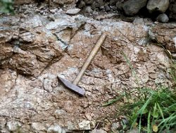
The site is on the southern slopes of the Belfast Hills facing onto the Lagan Valley. Exposures through much of the sequence are patchy but sufficient outcrop remains for a stratigraphy to be erected. Parts of the succession are repeated by N-S and NW-SE trending faults. The bulk of the Mercia Mudstone Group consisting of reddish brown calcareous mudstones and silty mudstones is only poorly exposed, occurring in intermittent sections between Collin Glen and Suffolk. 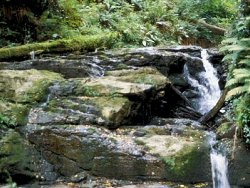 The Collin Glen section through the Penarth Group described by Tate (1864) appears to have been largely obscured by 1868. At one time a fairly extensive section was visible beside Glen Bridge but this is now almost completely covered by the concrete apron and a retaining wall and only about 25cm of dark grey shaly mudstone is now exposed. About 18m upstream from Glen Bridge there is a small exposure of vertical shales with thin limestone ribs. The best exposures of the Westbury Formation (Lower Rhaetian) occur at the bend in the river, 91m above Glen Bridge. Above the Collin Glen Formation there is a discontinuous section of ~6.7m details of which are given in Manning et al. (1970). These consist of dark grey marls, black mudstones and bluish-grey limestones, rich in fossils including two thin bone beds. The fauna, containing Rhaetavicula contorta, Eotrapezium [Aximus] concentricum, Eotrapezium ewaldi and Protocardia rhaetica is typical of the Westbury Beds of the Lower Rhaetian and of the Rhaetavicula contorta Zone. Fish remains occur throughout the shales, mudstones and argillaceous mudstones. Approximately 27m upstream of this section possible Upper Rhaetian Lilstock Formation strata consist of micaceous calcareous mudstones. There is no outcrop of the Waterloo Mudstone Formation SW of Collin Glen. To the NE the strata may owe their preservation from erosion to movement along the Collin Glen Fault in post-Lias times. Three small isolated sections of shaly mudstones are the only exposures of the Waterloo Mudstone Formation in Collin Glen. About 220m NNW of Glen Bridge, in a section in the west bank of the river, 5.7m of dark grey partly fossiliferous shaly mudstones are exposed. The top 4.9m of strata consists of ten beds with four shelly bands. The faunal list is: Diademopsis sp., pentacrinoid ossicles, echinoderm fragments, Astarte sp., Camptonectes sp., Cardinia hennocquii, Cardinia sp., Chlamys sp., Liostrea irregularis, Liostrea sp., Lima gigantea, Lucina?, Mactromya?, Modiolus laevis, Modiolus sp., Palaeoneilo galatea, Parallelodon hettangiensis, Pseudolimea sp., Protocardia phillippiana, Protocardia sp., Thracia?, ?Schlotheimia sp., and ostrocods. Only Hettangian Stage fossils have been identified, probably from the liasicus Zone. The Hibernian Greensands Formation is well exposed in Collin Glen with the Belfast Marls Member, Island Magee Siltstones Member and the Collinwell Sands Member all found. The most extensive section, and what is generally regarded as the type section, was previously exposed on the west bank of the river, 412m upstream from Glen Bridge. It was recorded as: GLAUCONITIC SANDS AND SANDSTONES - Collinwell Sands Member: Glauconitic sandstone, pale grey, medium-grained, with a little mica and much glauconite - ~0.9m YELLOW SANDSTONES AND GREY MARLS - Island Magee Siltstones Member: Sandstone, pale yellowish grey and grey, fine to slightly medium-grained with a few grains of glauconite in the top 30cm; serpulids and oyster fragments - 2.1m Sandstone, dark grey and brownish grey, fine-grained, with a little mica, fossiliferous. Some irregular nodules of hard, slightly calcareous, fine-grained sandstone - 3.7m GLAUCONITIC SANDS - Belfast Marls Member: Glauconitic sand or sand-rock, greenish black, composed almost entirely of glauconite. The bottom 30cm contain small (6-12mm in diameter) pebbles, many dark or black and highly polished; these pebbles occur mainly in the lowest 5-8cm where the matrix is clayey. The top 23cm have less glauconite grains where the rock passes up into dark grey and grey fine-grained sandstone. Exogyra obliquata fairly common 1.8m up from base - 2.6m The Collinwell Sands Member yielded Acila sp., indeterminate cardiids, Chlamys aspera, Entolium orbiculare, Exogyra obliquata, Gryphaesstrea canaliculata, Inoceramus sp., Thetironia laevigata, Schloenbachia subvarians, fish debris and vertebrae. The following fossils were obtained from the lower group of the Island Magee Siltstones Member: Flabellina sp., Rotularia concava, Holaster sp., cf. Toxaster murchisonianus, indeterminate rhynconellid, Arctostrea colubrina, Gryphaeostrea canaliculata, Neithea quinquecostata, Panopea ? and Pycnodonte vesicularis, whilst Rotularia concava, Arctostrea colubrina, Anomia sp., Chlamys aspera, Exogyra columba, Exogyra obliquata and Neithea aequicostata were collected from the higher group of beds. The Hibernian Greensands Formation is also exposed 347m NNW of the Glen Bridge but the best exposure is probably at the waterfall. 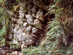 Upstream from the waterfall the higher beds of the Hibernian Greensands Formation lie in an inaccessible gorge but they are accessible 64m to the north at the junction with the Chalk. The Collinwell Sands Member is represented by glauconitic sandstones containing Chlamys robinaldina and an elasmobranch tooth. The formerly exposed basal beds of the Ulster White Limestone Formation, were medium-grained chalky sandstone and glauconitic chalk. Small quartz pebbles are present and there is much glauconite; fragments of oysters have been observed. The Glauconitic Chalk Member is 0.45m thick and flint nodules occur to within 0.15m of the bottom. On the east bank of the river, the Conglomerate Bed, 0.3m thick, is a calcareous, glauconitic sandstone containing sponges and some cobbles of glauconitic sandstone. In the gorge above the waterfall the basal beds are well exposed when the river is low. Many of the members identified in the Rathlin Basin are not found in this section. No Santonian members are present and the Creggan Chalk Member is only thinly developed. The members from the Boheeshane Chalk to the Glenarm Chalk are absent but the Senonian Portrush and Ballymagarry members are found together with the Maastrichtian Tanderagee Member. | |
| Importance: | |
The site is of national importance because of the range of Mesozoic strata preserved. It provides a representative section for the Lagan Valley, demonstrating the important controls of tectonic highs on sedimentation. It is the type locality for the Collin Glen Formation and is the most westerly outcrop of the Penarth Group and Waterloo Mudstone Formation. | |
| Interpretation: | |
The Collin Glen section contains one of the most complete sequences through the Mesozoic in N. Ireland. The absence of much of the Senonian strata illustrates that sedimentation has been strongly influenced by the fact that the Lagan Valley was a more positive tectonic area than the Larne-Lough Neagh Basin to the north. Overlapping and progressive thinning from the Larne-Lough Neagh Basin can be demonstrated. | |
| Conclusions: | |
The Collin Glen section, although consisting in part of only patchy exposure, provides one of the best sequences of the Mesozoic in the Lagan Valley. The thickness changes and non- sequences that occurred because of the influence of tectonics on sedimentation can be demonstrated. As the type locality of the Collin Glen Formation and with major outcrops of the Hibernian Greensands Formation, it is worthy of conservation. | |
| Notes: | |
For information on other Triassic sites see Key Site 1197 - Brown's Bay, Island Magee Key Site 1198 - Cloghfin Port, Island Magee Key Site 1200 - Scrabo Hill - Triassic Key Site 1201 - Milltown Key Site 1202 - Drapersfield Quarry Key Site 1203 - Lissan Water Key Site 1204 - Curraghlane. For general information on the Triassic System in N. Ireland see Key Site 1192 - The Triassic System in N. Ireland - Introduction. | |
| Keywords | |
|---|---|
| Rocks: | Glauconitic sandstone, Greensand, Limestone, Marl, Mudstone, Sand, Sandstone |
| Fossil Groups: | Brachiopod, Crinoid, Crustacea, Echinoderm, Fish |
| Structures: | fault |
| Relations: | Marine sediments |
| Measurements | |||||
|---|---|---|---|---|---|
| Length: | 300 m+ | Width: | Height: | ||
| Depth: | Area: | ||||
| Access | |
|---|---|
| Approach: | The site is on the southern slopes of the Belfast Hills facing onto the Lagan Valley. Access is from a number of carparks but the complete sequence can perhaps be best visited from the Andersonstown Road entrance. |
| Management: | |
These exposures lie within Collin Glen Forest Park and National Trust property to the north of Glen Bridge. This presumably would protect it from development. Any road improvements at Glen Bridge could result in the removal of outcrop but might also give an opportunity to open up a section. | |
| Uses | |
| Uses: | Recreation |
| References (5) | |||
|---|---|---|---|
| Hull, E., Warren, J.L. & Leonard, W.B., 1871. The country around Belfast, Lisburn and Moira. Memoirs of the Geological Survey of Ireland. | |||
| Hume, W.F., 1897. The Cretaceous strata of County Antrim. Quarterly Journal of the Geological Society of London, vol. 53, pp.540-606. | |||
| Manning, P.I., Robbie, J.A. & Wilson, H.E., 1970. Geology of Belfast and the Lagan Valley. Memoirs of the Geological Survey Northern Ireland. | |||
| Portlock, J.E., 1843. Report on the Geology of the County of Londonderry and of parts of Tyrone and Fermanagh. HMSO, Dublin. | |||
| Tate, R., 1864. On the Liassic strata of the neighbourhood of Belfast. Quarterly Journal of the Geological Society of London, vol. 20, pp.103-114. | |||
| Record type: | ESCR report | ||
| Entered by: | E M Porter | ||
| Enlander, I., Dempster, M. & Doughty, P., 2026. Collin Glen, County Antrim, site details. [In] Earth Science Conservation Review. https://www.habitas.org.uk/escr/site.php?item=1199. Accessed on 2026-11-06. |
| Previous Site | Next Site |