
| Previous Site | Next Site |
Earth Science Conservation Review
| Golan Burn, Gortin | Tyrone |
| Site number: | 138 | ||
| ESCC: | EO | ||
| Locality Type: | Stream section | Status: | ESCR |
| Grid Reference: | H523872 Centroid | ||
| Google maps: | 54.73052,-7.18816 | ||
| County: | Tyrone | Council area: | Fermanagh & Omagh District Council |
| Period: | Carboniferous, Precambrian | ||
| Stages: | Courcyean, Dalradian | ||
| Lithostrat: | Glenelly Formation, Golan Burn Member, Owenkillew Sandstone Group | ||
| Site Description | |
|---|---|
 | |
| Highlights: | |
The Golan Burn contains the stratotype for the Golan Burn Member (Geological Survey of Northern Ireland, 1995) a distinctive calcareous (impure meta-limestone) horizon within the Glenelly Formation. Such identifiable marker horizons are comparatively rare within the otherwise homogeneous, predominantly siliciclastic Glenelly Formation. The Golan Burn Member is therefore potentially important in establishing local and regional stratigraphic correlation. | |
| Introduction: | |
This site is located in Golan Burn, a north bank tributary of the Owenkillew River. The area of interest lies on the upstream side of Golans Bridge [H526 871] which is located on the road between Gortin and Scotch Town, approximately 3km NE of Gortin. On the first edition of the one inch to one mile geological map of the area (Sheet 26, Draperstown) (Geological Survey of Ireland, 1882) the limestone in Golan Burn was shown as a separate unit within the otherwise undifferentiated strata described in the Map Explanation as "Chloritic, talcose & micaceous schist". These strata were referred to as being of "Lower Silurian" age. In the Geological Survey Memoir which accompanied the geological map, Nolan (1884) described the limestone in Golan Burn and noted that a quarry had been opened in it but abandoned. Hartley (1938) published the first detailed lithostratigraphic map of the Sperrin Mountains and included the limestone at Golan Burn in what he referred to as the "Tourmaline Schists of Glenelly". These rocks form part of the Glenelly Formation as defined by Arthurs (1976). Most recently, the 1:50,000 scale, second edition of the Draperstown map (Geological Survey of Northern Ireland, 1995) includes a redefined Glenelly Formation which includes the Golan Burn Member, see table below. Alsop et al., (1993) have recently proposed an alternative interpretation of the stratigraphy and structure of the southern Sperrin Mountains. They include all of the formations (Dart, Glenelly, Glengawna and Mullaghcarn Formations) within what they refer to as the "Sperrin Formation". They have suggested that all these formations belong to the Argyll Group (Middle Dalradian). This interpretation has been challenged by Arthurs and Johnston & Smith (Arthurs et al., 1994) and is the subject of ongoing controversy. TABLE TO BE ADDED Dalradian stratigraphy and ESCR sites in the southern Sperrin Mountains. | |
| Description: | |
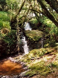
In the Golan Burn, directly upstream from Golan Bridge, the outcrop consists mainly of silvery and pinkish grey coloured quartz-mica schist and semipelite with thin units of grey quartzose psammite flags and very occasional thin lenses of very fine-grained grey micritic? limestone. These strata are broadly representative of the Glenelly Formation throughout the Sperrin Mountains region. Approximately 100m upstream from Golan Bridge, the metamorphic rocks (Glenelly Formation) are purplish-red and iron-stained and are overlain unconformably by Carboniferous rocks which are exposed intermittently for about 100m in the banks of the river. The Carboniferous rocks are mainly reddish brown, blocky, sometimes micaceous siltstone and gritty siltstones which form the basal beds of the Owenkillew Sandstone Group (Courceyan age). The Owenkillew Sandstone Group forms an elongate outlier of sandstones and siltstones which extends 20km westwards from Golan Burn to Victoria Bridge and Ardstraw, Co. Tyrone. Upstream from the last outcrop of Carboniferous siltstone, there is a return to intermittent outcrops of typical Glenelly Formation lithologies containing occasional thin units of limestone. At the waterfall [H5225 8720], 300m upstream from Golan Bridge, there is a 10m thick sequence of thin impure meta-limestone with silvery schistose semipelite and fine-grained, slightly calcareous, quartzo-feldspathic psammites with calcareous veins and lenticles. 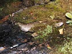 | |
| Importance: | |
Golan Burn is an important site containing the only exposure and stratotype (type section) of the Golan Burn Member. This limestone member is one of only a few calcareous marker horizons which, together with thin green bed units, offer some hope for mapping a regional stratigraphy within the generally monotonous turbidite sequence (Southern Highland Group) succession in the southern Sperrin Mountains. The site is also important because it contains a rare exposure of the Carboniferous unconformity at the base of the Owenkillew Sandstone Group. | |
| Interpretation: | |
The metamorphic rocks at this site are mainly turbidite facies sediments which were originally deposited in or proximal to a subsiding marine basin during Upper Dalradian times. The presence of a significant proportion of limestone and carbonate rich rocks (Golan Burn Member) is evidence that at least periodically, the water depth in or marginal to the depositional basin was sufficiently shallow to favour the formation of marine limestone. During the late-Caledonian Orogeny, these sediments were deformed, folded and subjected to regional metamorphism. Metamorphic mineral assemblages typically include chlorite, biotite, muscovite and albite-oligoclase with tourmaline present as a characteristic accessory in semi-pelitic lithologies. Such mineral assemblages are consistent with the rocks having experienced Greenschist Facies conditions within the Barrovian Facies Series (Arthurs, 1976). Structurally, the Glenelly Formation lies on the overturned limb of the Sperrin Overfold. Consequently these strata dip towards the north-west and young towards the south-east Primary way-up evidence is however rare in the Glenelly Formation because of the advanced state of recrystallization in these rocks. In this structural zone of the Sperrin Mountains, the rocks generally have a well developed schistosity defined by of a penetrative north-west dipping sometimes crenulating composite planar fabric (S1-S3?). During post- Caledonian to pre-Carboniferous times, the metamorphic rocks were exposed to erosion and denuded prior to the encroachment of a northwards transgressive sea during Lower Carboniferous (Courceyan) times. | |
| Conclusions: | |
Golan Burn is a site of national importance containing the type section and sole exposure of the Golan Burn Member. Recent experience shows that such lithological marker horizons offer perhaps the only practical means of lithostratigraphically subdividing the predominantly turbiditic successions of the Southern Highland Group in Northern Ireland. The coincidental exposure of the Lower Carboniferous (Owenkillew Sandstone Group) unconformity adds significantly to the general geological interest at the site | |
| Notes: | |
For site specific information and references on other Dalradian sites in the Sperrin Mountains, Londonderry and Tyrone see the following sites: For Central and Southern Sperrin Mountains: Key Site 130 - Butterlope Glen Key Site 131 - Craig Key Site 132 - Mullaghcarbatagh Key Site 133 - Henry's Bridge, Glensass Burn Key Site 134 - Oughtboy Burn Key Site 135 - Garvagh Burn Key Site 136 - Barnes Gap Key Site 137 - Barnes Burn Key Site 139 - Glendarragh Burn, Glenlark Key Site 140 - Mountfield Old Quarry Key Site 141 - McNally's Burn, Broughderg For North Sperrin Mountains and Londonderry: Key Site 142 - Letterbrat Quarry Key Site 143 - Banagher Glen Quarry Key Site 144 - Strabane Quarry Key Site 145 - Glenmornan River, Artigarvan Key Site 146 - Balix Hill Key Site 147 - Drain Quarry Key Site 148 - Kildoag Quarry Key Site 149 - Loughermore Mountain Key Site 150 - Burntollet and Tamnymore Wood Key Site 151 - Dog Leap, Limavady Key Site 152 - Kittybane Quarry Key Site 153 - Prehen Quarry Key Site 154 - Creevagh Hill Old Quarry For site specific information and references on other Dalradian sites in North-east Antrim see the following sites: Key Site 155 - Benvan Key Site 156 - Escort Port Key Site 157 - Torr Head Key Site 158 - Altmore Burn Key Site 159 - Leckpatrick Point Key Site 160 - Carnaneigh Key Site 161 - Loughan Bay Key Site 162 - Loughareema Channel Key Site 163 - Knocknacarry Bridge Key Site 164 - Cushendun Bay and Rock Port For general information on the Dalradian rocks of Northern Ireland see the following site: Key Site 124 - The Dalradian Rocks of Northern Ireland For general and site specific information on the Pre-Dalradian rocks of Northern Ireland see the following site: Key Site 123 - The Pre-Dalradian Rocks of Northern Ireland For general information and an extensive reference list on the Precambrian of Northern Ireland see the following site: Key Site 122 - An Introduction to the Precambrian of Northern Ireland | |
| Keywords | |
|---|---|
| Rocks: | Limestone, Psammite, Schist |
| Access | |
|---|---|
| Approach: | Access is via the parapet of Golan Bridge or over fields and fences along the river banks. Clearly some arrangement will be necessary to regulate access to the site across privately owned farmland. |
| Management: | |
The site lies entirely within the confines of Golan Burn. Currently, the river is well fenced from the pasture land along both banks. Access is via the parapet of Golan Bridge or over fields and fences along the river banks. Clearly some arrangement will be necessary to regulate access to the site across privately owned farmland. The site does not appear to be under any immediate threat from development or dumping. The main features of geological interest at this site should be sufficiently robust to withstand all reasonable sampling pressures. | |
| References (5) | |||
|---|---|---|---|
| Alsop, G.I. & Hutton, D.H.W., 1993. Major southeast-directed Caledonian thrusting and folding in the Dalradian rocks of mid-Ulster: implications for Caledonian tectonics and mid-crustal shear zones Geological Magazine, vol. 130 pt. 2, pp.233-244. | |||
| Arthurs, J.W., 1976a. The geology and metalliferous mineral potential of the Sperrin Mountains area Geological Survey of Northern Ireland Special Report. | |||
| Arthurs, J.W., Johnston, T.P., Smith, R.A., Alsop, G.I. & Hutton, D.H.W., 1994. Discussion on major southeast-directed Caledonian thrusting and folding in the Dalradian rocks of mid-Ulster: Implications for Caledonian tectonics and mid-crustal shear zones Geological Magazine, vol. 131 pt. 3, pp.417-421. | |||
| Hartley, J.J., 1938. The Dalradian rocks of the Sperrin Mountains and adjacent areas in Northern Ireland Proceedings of the Royal Irish Academy, vol. 44 pt. B. | |||
| Nolan, J., 1884. Explanatory memoir to accompany Sheet 26 of the maps of the Geological Survey of Ireland Memoirs of the Geological Survey of Ireland. | |||
| Map(s): | GSI (1882). 1:63,360 Geological Sheet 26 (Draperstown), Dublin, OS for GSI GSNI (1995). 1:50,000 Draperstown, Northern Ireland Sheet 26, Solid, BGS, Keyworth, Nottingham | ||
| Record type: | ESCR report | ||
| Entered by: | E M Porter | ||
| Last updated: | 6 Jun 2005 | ||
| Enlander, I., Dempster, M. & Doughty, P., 2026. Golan Burn, Gortin, County Tyrone, site details. [In] Earth Science Conservation Review. https://www.habitas.org.uk/escr/site.php?item=138. Accessed on 2026-11-06. |
| Previous Site | Next Site |