
| Previous Site | Next Site |
Earth Science Conservation Review
| Prehen Quarry - Dalradian | Londonderry |
| Site number: | 153 | ||
| ESCC: | ED | ||
| Locality Type: | Quarry (disused) | Status: | ESCR |
| Grid Reference: | C423147 Centroid | ||
| Google maps: | 54.97847,-7.33934 | ||
| County: | Londonderry | Council area: | Derry City & Strabane District Council |
| Period: | Precambrian | ||
| Stages: | Dalradian | ||
| Lithostrat: | Ballykelly Formation, Londonderry Formation, Southern Highlands Group | ||
| Site Description | |
|---|---|
 | |
| Highlights: | |
This quarry affords access to high quality 3-dimensional outcrop of a metagreywacke and slate turbidite succession. As a consequence of relatively low-strain and low-grade regional metamorphism, many original sedimentary structures are clearly visible as are relationships between bedding and cleavage. | |
| Introduction: | |
This site is a disused quarry located at Prehen, on the right bank of the River Foyle, approximately 2km south-south-west of Londonderry City centre. This quarry was worked extensively during World War II as a source of aggregates for building military installations around Londonderry. The quarry is surrounded by recent housing development, and access is via a path through woodland at the northern end of Prehen Park. Prehen Park is accessed via the A5 (Victoria Road south from Londonderry) and then along Hazelwood Avenue opposite the Everglades Hotel [C425 151]. On the first edition of the one inch to one mile geological map of the area (Strabane, Sheet 18) (Geological Survey of Ireland, 1888, Kinahan et al., 1889) these strata were included within the general category "mica schists". In a later memoir which described the geology of the area around Londonderry, the "mica schist" rocks (including those at Prehen) were noted as "passing gradually into sericitic-phyllite and this again into roofing slate". Reference was made to the fact that some tracts of ground have, "undergone but slight alteration during the epoch of metamorphism . . . and have a strong resemblance to some of the fossiliferous beds of Lower Silurian age in North Wales". Attention was also drawn to the fact that these strata also compare very closely with the "Ballygowan grits of County Down" (Wilkinson et al., 1908). On the Geology Map of Northern Ireland (Geological Survey of Northern Ireland, 1977), the strata at this site are included within the Lough Foyle Succession. This loosely defined division encompassed the thick succession of metagreywackes at the core of a broad syncline centred on Lough Foyle (Lough Foyle Syncline). Pitcher et al. (1972) indicated that these rocks were of Upper Dalradian age and referred to them collectively as the Lough Foyle (Lough Awe) Succession. The first formal stratigraphic subdivision of the Lough Foyle Succession came as a result of mapping by the Geological Survey of Northern Ireland. The lithostratigraphic terms Claudy, Ballykelly and Londonderry formation were introduced on the 1:50,000 scale second editions of the Limavady and the Londonderry Sheets (Geological Survey of Northern Ireland, 1981, 1995). A precise stratigraphic definition of the strata at Prehen Quarry, Kittybane Quarry and the surrounding area awaits the forthcoming resurvey of the Strabane area. In the meantime, these rocks should probably be included within the lowermost part of the Londonderry Formation(Southern Highland Group), see table below, (Bazley et al., 1997). TABLE TO BE ADDED Dalradian stratigraphy and ESCR sites in the northern Sperrin Mountains. | |
| Description: | |
Prehen Quarry is disused, partially flooded and overgrown. The pit is about 25m deep, measures about100m x 75m and is elongate in the north-east - south-west, parallel to the direction of strike (66°48°NW) of the strata. The most easily accessible and informative exposures are found along the north-western face of the quarry. The southern faces generally expose single bedding surfaces and are often too steep or overgrown to allow safe access. The succession at Prehen consists of slightly calcareous schistose grits (metagreywackes) interbedded with phyllitic schist and pelite schists. The dominant gritty and psammitic lithologies are characteristically pale green to mid grey in colour. The principal detrital minerals include greyish-blue quartz, pinkish orthoclase feldspar. Red jasper, greenish mica , calcite and some epidote are the other main constituents of the rock (Wilkinson, 1908). Many of the thicker, coarse-grained units show clear and repeated graded bedding. Units commonly have coarse-grained bottoms on sharp bases and grade upwards to finer grained, parallel laminated and more phyllitic tops. This younging evidence together with the geometry of various sedimentary bedforms indicates that the beds in this quarry are right way up and "young" towards the north-west. A penetrative cleavage cuts affects all the rocks throughout the quarry and has a consistent orientation (64°55°NW). This cleavage is broadly co-planar with bedding and the bedding parallel S1?. The cleavage dips to the north-west at consistently higher angles than the bedding. 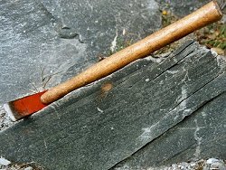 Across much of the outcrop, S2 is broadly co-planar with S0,1? and is axial planar to some minor, south-easterly verging similar folds (F2). Elsewhere in the quarry, S2 strongly crenulates a composite S0,1 in a manner commonly seen in the Ballykelly Formation further south in the Sperrins. Cleavage intersection lineations (L2) are common especially in more phyllitic horizons. These structures generally plunge at about 10°-15° to the north-east and are formed by the intersection of the dominant S2 on S0,1. Late stage, post D2 brittle kink-fold structures occur sporadically throughout the quarry. The axes of these structures trend 060°80°SE and the folds verge towards the south-east. | |
| Importance: | |
Prehen Quarry contains excellent exposure of turbiditic metasedimentary rocks belonging to the Londonderry Formation. These rocks are located on the southern limb of the Lough Foyle Syncline and are relatively undeformed, in comparison with strata further south in the Sperrin Mountains. Consequently, many original sedimentary structures are preserved and it is possible to study the sedimentary protolith in some detail as well as structural features including folding and beddingcleavage relationships. | |
| Interpretation: | |
The rocks of the Londonderry Formation were originally deposited as distal turbidites in an open water marine environment within a trough or basin which subsided gradually to accommodate the accumulating sediments, (Bazley, 1997). During the Caledonian Orogeny these sediments, in common with Dalradian rocks elsewhere in the British Isles, underwent a major regional deformation accompanied by metamorphism. As a result of folding and SE-directed translation, these rocks now lie on the northern, upwards facing limb of the Sperrin Overfold which forms the southern limb of the complementary Lough Foyle Syncline. These two major structures have been interpreted as south-westerly continuations of the Tay Nappe and the Loch Awe Syncline in Scotland (Pitcher et al., 1972, Bazley et al. 1997). The metamorphism that accompanied deformation was comparatively low-grade. The common occurrence of quartz-chlorite-epidote assemblages in these rocks is consistent with metamorphism having taken place under quartz-albite-muscovite-chlorite sub-facies conditions in the Greenschist Facies. | |
| Conclusions: | |
A strong case can be made for conserving at least part of Prehen Quarry as a site of national importance. In an area of otherwise poor and sporadic exposure, these comparatively low-strain rocks provide an opportunity to study the sedimentary protolith of the lowermost part of the Londonderry Formation. | |
| Notes: | |
For site specific information and references on other Dalradian sites in the Sperrin Mountains, Londonderry and Tyrone see the following sites: For Central and Southern Sperrin Mountains: Key Site 130 - Butterlope Glen Key Site 131 - Craig Key Site 132 - Mullaghcarbatagh Key Site 133 - Henry's Bridge, Glensass Burn Key Site 134 - Oughtboy Burn Key Site 135 - Garvagh Burn Key Site 136 - Barnes Gap Key Site 137 - Barnes Burn Key Site 138 - Golan Burn Key Site 139 - Glendarragh Burn, Glenlark Key Site 140 - Mountfield Old Quarry Key Site 141 - McNally's Burn, Broughderg For North Sperrin Mountains and Londonderry: Key Site 142 - Letterbrat Quarry Key Site 143 - Banagher Glen Quarry Key Site 144 - Strabane Quarry Key Site 145 - Glenmornan River, Artigarvan Key Site 146 - Balix Hill Key Site 147 - Drain Quarry Key Site 148 - Kildoag Quarry Key Site 149 - Loughermore Mountain Key Site 150 - Burntollet and Tamnymore Wood Key Site 151 - Dog Leap, Limavady Key Site 152 - Kittybane Quarry Key Site 154 - Creevagh Hill Old Quarry For site specific information and references on other Dalradian sites in North-east Antrim see the following sites: Key Site 155 - Benvan Key Site 156 - Escort Port Key Site 157 - Torr Head Key Site 158 - Altmore Burn Key Site 159 - Leckpatrick Point Key Site 160 - Carnaneigh Key Site 161 - Loughan Bay Key Site 162 - Loughareema Channel Key Site 163 - Knocknacarry Bridge Key Site 164 - Cushendun Bay and Rock Port For general information on the Dalradian rocks of Northern Ireland see the following site: Key Site 124 - The Dalradian Rocks of Northern Ireland For general and site specific information on the Pre-Dalradian rocks of Northern Ireland see the following site: Key Site 123 - The Pre-Dalradian Rocks of Northern Ireland For general information and an extensive reference list on the Precambrian of Northern Ireland see the following site: Key Site 122 - An Introduction to the Precambrian of Northern Ireland This site is also important for Structural Geology. See Key Site 644 - Prehen Quarry. | |
| Keywords | |
|---|---|
| Rocks: | Greywacke, Turbidite |
| Structures: | syncline |
| Access | |
|---|---|
| Management: | |
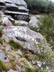
Prehen Quarry has been derelict for a long time. Many of the faces, particularly on the north-western side of the quarry are now overgrown. Parts of the quarry floor are also overgrown and in places there is standing water of an uncertain depth. No significant dumping has taken place in the quarry but there is evidence of occasional fly-tipping and vandalism. There is painted graffiti on bedding surfaces across much of the south-eastern side of the quarry and there is much broken glass. The site is isolated from surrounding housing developments and is apparently used as a play area and as a drinking venue. Despite the derelict and overgrown nature of the quarry, the principle features of geological interest remain easily accessible and can be viewed at a number of alternative points particularly on the north-western face. There is no need to impose restrictions on collecting from this point beyond requesting that hammering should be kept to a minimum. Perhaps the greatest conceivable threat to the integrity of this site at present is that at some future date the quarry might be used as a landfill site. As with all quarries, extreme care should be exercised when examining the quarry faces. All such areas are potentially unstable and rockfalls can be precipitated by hammering or moving across unstable boulder screes. The flooded floor of the quarry also poses a potential hazard to people visiting the site. |
| References (4) | |||
|---|---|---|---|
| Bazley, R.A.B., Brandon, A. & Arthurs, J.W., 1997. Geology of the Country around Limavady and Londonderry GSNI Technical Report 97/1. | |||
| Kinahan, G.H., Wilkinson, S.B., Nolan, J. & Eagan, B.A., 1889. Explanatory Memoir to accompany Sheet 17 of the maps of the Geological Survey of Ireland Memoirs of the Geological Survey of Ireland. | |||
| Pitcher, W.S. & Berger, A.R., 1972. The Geology of Donegal: A study of granite emplacement and unroofing Wiley - Interscience, New York & London. | |||
| Wilkinson, S.B., McHenry, A., Kilroe, J.R. & Seymour, H.J., 1908. The geology of the country around Londonderry Memoirs of the Geological Survey of Ireland, HMSO, Dublin. | |||
| Map(s): | GSI (1888). 1:63,360 Geological Sheet 17 (Strabane), Dublin, OS for GSI GSNI (1981). 1:50,000 Limavady, Northern Ireland Sheet 12 and part of Sheet 6, Solid, Southampton, OS for GSNI GSNI (1997). 1:250,000 Northern Ireland, Solid Geology (2nd edition), BGS, Keyworth, Nottingham | ||
| Record type: | ESCR report | ||
| Entered by: | E M Porter | ||
| Enlander, I., Dempster, M. & Doughty, P., 2026. Prehen Quarry - Dalradian, County Londonderry, site details. [In] Earth Science Conservation Review. https://www.habitas.org.uk/escr/site.php?item=153. Accessed on 2026-11-08. |
| Previous Site | Next Site |