
| Previous Site | Next Site |
Earth Science Conservation Review
| Tullyhona, Brookfield and Trien; Tullyhona Rising Cave | Fermanagh |
| Site number: | 334 | File Number: | H13 |
| ESCC: | IC | ||
| Locality Type: | Cave | Status: | ASSI |
| Grid Reference: | H15333373 | ||
| Google maps: | 54.25241,-7.76525 | ||
| County: | Fermanagh | Council area: | Fermanagh & Omagh District Council |
| Period: | Quaternary, Carboniferous | ||
| Stages: | Asbian, Holocene, Visean | ||
| Lithostrat: | Dartry Limestone Formation, Knockmore Limestone Member | ||
| Site Description | |
|---|---|
 | |
| Description: | |
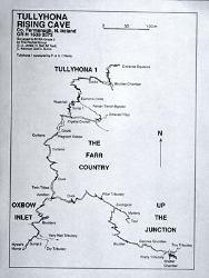
I - Hydrology The main point input to Tullyhona Rising Cave is derived from two streams draining the northern slopes of Trien Mountain. These streams sink in two distinct groups of sinkholes; Dick's Sinks to the east which feed the stream in Up The Junction Passage and Whiskey Holes to the west which feed the stream in Oxbow Inlet Series. Several small inlets are encountered in the cave and these may represent small autogenic streams on the surface or accumulated allogenic input. The two streams meet at the Junction to form the Main Stream which resurges at Tullyhona Rising. II - Underground Karst The main underground karst feature in the Tullyhona area is Tullyhona Rising Cave. Tullyhona Rising and the cave entrance are located at the head of a small stream which rises at the Glencar - Dartry Limestone contact in Tullyhona townland. The main streams feeding the stream in Tullyhona Rising Cave sink at Dick's Sinks and Whiskey Holes. 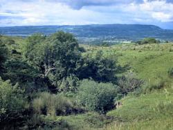 From the Junction the stream flows through The Farr Country, 150m of magnificent passage consisting of 5m square passage with a number of larger chambers and a 25m long duck towards the upstream end of the passage. At the end of The Farr Country the passage trends sharply E-W. The stream flows north after 25m, cutting down to Sump 1. The E-W passage continues at high level to Crystal Crunch, a 2m wide phreatic tube with a wide vadose slot in the floor of the passage. 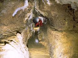 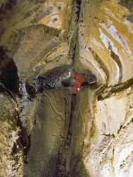 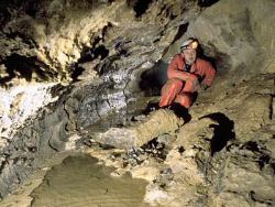 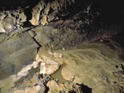 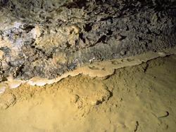 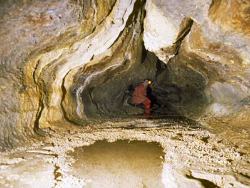 Sump 1 is 3.5m deep and 9m long and forms a U-bend in section. The stream emerges from Sump 1 at the head of a 4m high waterfall, forming a perched sump. 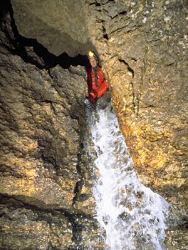 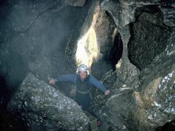 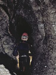 From the Fenian Terror - stream passage junction, the stream flows through a series of strongly joint controlled passages, initially with deep water and then steeply descending vadose passages with a number of cascades. There are no clastic sediments in this area of the cave. The passage shape changes dramatically at The Ducks, becoming wide and low, rather than high and narrow. 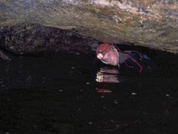 From the Boulder Chamber the stream passage consists of approximately 2m by 2m passages with abundant breakdown blocks of mudbank limestones obstructing the passage. Close to the cave entrance the passage exposes the Dartry Limestone - Glencar Limestone contact in the passage floor. 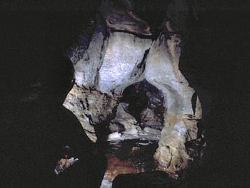 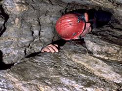 Calcite speleothems are particularly abundant in The Farr Country but are rare in Tullyhona 1, Up The Junction and the Oxbow Inlet. Coarse clastic stream deposits are well developed in Up The Junction and The Oxbow Inlet. 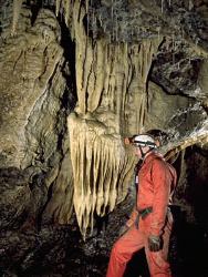 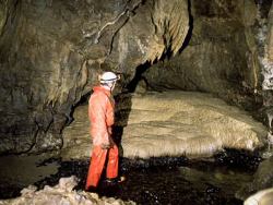 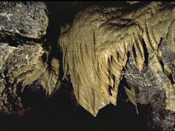 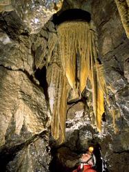 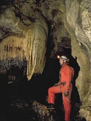 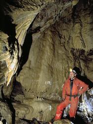 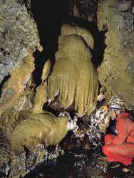 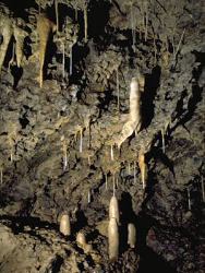 | |
| Interpretation: | |
I - Hydrology The hydrology of the Tullyhona area appears to be relatively simple, with larger streams sinking into larger sinkholes, with diffuse input from solution doline areas. All the water which sinks in the area resurges at Tullyhona Rising. A permanent surface stream immediately east of and below Dick's Sinks has a small rising approximately 30m from Dick's Sinks and this may indicate partial capture of the stream sinking at Dick's Sinks by the permanent surface stream. II - Underground Karst Tullyhona Rising Cave is a dendritic vadose cave developed within carbonate mudbanks of the Knockmore Limestone Member. Sink location is controlled by the fault contact between the Glenade Sandstone and Dartry Limestone Formations. The resurgence level is controlled by the Dartry - Glencar Limestone Formation contact. The initial inlet passages, Up The Junction and the Oxbow Inlet are joint controlled vadose passages with abundant clastic deposits derived from the surface streams. After these streams join, the passage increases in size probably due to increased flow in this section of cave. The significant change in passage direction at the end of the Farr Country occurs where a major E-W oriented fault or joint is reached by the stream. This E-W oriented passage (Crystal Crunch) and Fenian Terror Bypass are probably the original route taken by the stream, the N-S oriented passage through Sump 1 having captured the stream as it cut down, leaving Crystal Crunch and Fenian Terror abandoned. The perched Sump 1 and the waterfall also show dolomite projections and Fenian Terror and the waterfall appear to be controlled by parallel fractures. From the waterfall the stream passage cuts rapidly down a joint controlled passage to The Ducks and the Boulder Chamber where a thick shale band has controlled passage form and led to extensive roof breakdown. The following passages are formed within the Dartry Limestone immediately above the Glencar - Dartry Limestone contact and thin shales within the carbonate mudbanks have allowed extensive breakdown of mudbank limestones to take place. At the entrance the passages are restricted and low, reflecting the control exerted on passage form by the thinly bedded limestones and shales of the upper Glencar Limestone. | |
| Notes: | |
Tullyhona Rising Cave is a system located at the eastern end of the Marlbank area, in the Marlbank-Cuilcagh Mountain Region. For general information on the systems and features of this area, including this one, and a reference list, see site description 'Marlbank-Cuilcagh Mountain Region; Tullyhona, Brookfield and Trien'. | |
| Keywords | |
|---|---|
| Rocks: | Limestone |
| Structures: | fault |
| Geomorph: | dendritic river cave, sinkhole, speleothem |
| Measurements | |||||
|---|---|---|---|---|---|
| Length: | 1500 m+ | Width: | Height: | ||
| Depth: | 65 m | Area: | |||
| Access | |
|---|---|
| Management: | |
Approach to the entrance of Tullyhona Rising Cave is normally made through land owned by the Department of Agriculture N.I. (Forestry Service). The entrance to the cave, and the cave system itself, lies on, and under, private land. The cave is suitable for visits by experienced cavers only and is not used by educational etc. groups. Internal Threats: Tullyhona Rising Cave consists mainly of active river passages. The passages from the entrance to the downstream end of Fenian Terror Bypass are devoid of calcite speleothems and are high energy, being prone to extreme flooding. The Bypass and the passage immediately at the end contain no significant deposits and damage is unlikely to this point. The floor of Crystal Crunch, however, is completely covered in well developed gour pools and other calcite speleothems which can be avoided by walking with one foot on each ledge either side of the passage.
|
| Record type: | ESCR report | ||
| Entered by: | Doughty, P.J. | ||
| Last updated: | 24 Dec 2003 | ||
| Enlander, I., Dempster, M. & Doughty, P., 2026. Tullyhona, Brookfield and Trien; Tullyhona Rising Cave, County Fermanagh, site details. [In] Earth Science Conservation Review. https://www.habitas.org.uk/escr/site.php?item=334. Accessed on 2026-11-08. |
| Previous Site | Next Site |