
| Previous Site | Next Site |
Earth Science Conservation Review
| Marble Arch Karst; Monastir Caves | Fermanagh |
| Site number: | 350 | File Number: | H31 |
| ESCC: | IC | ||
| Locality Type: | Cave | Status: | ASSI |
| Grid Reference: | H119335 | ||
| Google maps: | 54.2507,-7.81742 | ||
| County: | Fermanagh | Council area: | Fermanagh & Omagh District Council |
| Period: | Quaternary | ||
| Stages: | Holocene | ||
| Site Description | |
|---|---|
 | |
| Description: | |
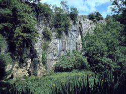
Caves associated with the underground course of the Aghinrawn River but not directly connected to Marble Arch Cave comprise: Monastir Cliff Caves The Monastir Cliff Caves comprise a lower active stream series associated with the Aghinrawn River sinking at the base of Monastir Cliff, and an upper, abandoned series of fossil cave, partially truncated by the cliff. The Aghinrawn River flows through a fine series of limestone gorges to the south of Monastir, 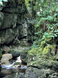 Monastir Sink At Monastir Sink many attempts have been made by cavers and cave divers to follow the underground course of the Aghinrawn River. These have been frustrated by extensive quantities of flood debris which have choked the passage. A connection has, however, been made from Monastir Sink to the fossil caves above. Upper Monastir Caves There are two main entrances to the upper Monastir Caves (Bruce's Pot and Pollbwee) and these have been connected. Bruce's Pot 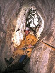 Upper Cradle - Pollnagapple - Monastir Way After sinking at Monastir Sink, the Aghinrawn River flows into a sumped section of passage. This re-emerges in a 600m long series of vadose passage with a number of sumped sections called Monastir Way. The final sumped section of passage is at the upstream end of Upper Cradle Cave (see Key Site 362 - Upper Cradle and Lower Cradle). This consists of ~150m of large stream passage, with good gours and flowstones in places. There are a number of abandoned fossil passages above the present stream passage. The river flows into a sump at the edge of Cradle Hole and re-emerges in Lower Cradle. | |
| Notes: | |
The Monastir Cliff Caves are a feature of the Marble Arch Karst of the Marlbank-Cuilcagh Mountain Region. For general information on the features and systems of the Marble Arch Karst, including this one, and a reference list, see site description 'Marlbank-Cuilcagh Mountain Region; Marble Arch Karst'. | |
| Keywords | |
|---|---|
| Minerals: | Calcite |
| Rocks: | Limestone |
| Geomorph: | cave, cliff, flowstone, gour pool, pothole, sinkhole, sump |
| Record type: | ESCR report | ||
| Entered by: | Doughty, P.J. | ||
| Last updated: | 24 Dec 2003 | ||
| Enlander, I., Dempster, M. & Doughty, P., 2026. Marble Arch Karst; Monastir Caves, County Fermanagh, site details. [In] Earth Science Conservation Review. https://www.habitas.org.uk/escr/site.php?item=350. Accessed on 2026-11-06. |
| Previous Site | Next Site |