
| Previous Site | Next Site |
Earth Science Conservation Review
| Western Marlbank; Polltullyard | Fermanagh |
| Site number: | 370 | File Number: | H03 |
| ESCC: | IC | ||
| Locality Type: | Cave, Sinkhole | Status: | ASSI |
| Grid Reference: | H09443241 | ||
| Google maps: | 54.24087,-7.8558 | ||
| County: | Fermanagh | Council area: | Fermanagh & Omagh District Council |
| Period: | Quaternary, Carboniferous | ||
| Stages: | Asbian, Holocene, Visean | ||
| Lithostrat: | Dartry Limestone Formation, Knockmore Limestone Member | ||
| Site Description | |
|---|---|
 | |
| Description: | |
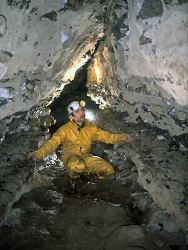
At Polltullyard a small stream sinks in a 6m deep doline with a 2m limestone scarp on the southeastern side. At the base of the scarp 20m of passage developed in the cherty facies of the Dartry Limestone can be followed to the top of a 30m shaft.
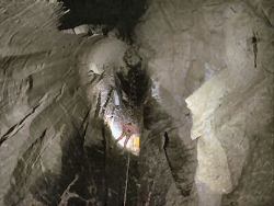  At the bottom of the shaft the stream sinking on the surface is met. Downstream the stream quickly disappears into pebbles and boulders. To the north a boulder slope descends for about 25m, bounded by a solid limestone wall on the north and on the south by massive gritstone boulders. This leads to a boulder filled chamber from where the stream disappears into a narrow rift. An abandoned passage runs parallel to the stream and after 30m encounters a choke of gritstone cobbles. Upstream an awkward 4m climb enters 200m of well developed phreatic/vadose canyon passage. There are a total of four inlets.   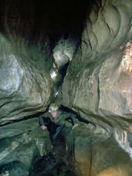 | |
| Notes: | |
Polltullyard is a feature of the Shannon Pot System of the Western Marlbank area, in the Marlbank-Cuilcagh Mountain Region. For general information on the systems and features of this area, including this one, and a reference list, see site description 'Marlbank-Cuilcagh Mountain Region; Western Marlbank'. | |
| Keywords | |
|---|---|
| Rocks: | Limestone |
| Structures: | rift |
| Geomorph: | cave, clastic sediments, doline, sinkhole |
| Measurements | |||||
|---|---|---|---|---|---|
| Length: | ~300 m | Width: | Height: | ||
| Depth: | Area: | ||||
| Record type: | ESCR report | ||
| Entered by: | Doughty, P.J. | ||
| Last updated: | 24 Dec 2003 | ||
| Enlander, I., Dempster, M. & Doughty, P., 2026. Western Marlbank; Polltullyard, County Fermanagh, site details. [In] Earth Science Conservation Review. https://www.habitas.org.uk/escr/site.php?item=370. Accessed on 2026-11-07. |
| Previous Site | Next Site |