
| Previous Site | Next Site |
Earth Science Conservation Review
| Curraghinalt Burn, near Gortin | Tyrone |
| Site number: | 521 | ||
| ESCC: | EO | ||
| Locality Type: | Stream section | Status: | ESCR |
| Grid Reference: | H571865 Approximate | ||
| Google maps: | 54.72371,-7.1138 | ||
| County: | Tyrone | Council area: | Fermanagh & Omagh District Council |
| Period: | Carboniferous, Precambrian | ||
| Site Description | |
|---|---|
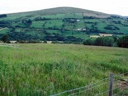 | |
| Highlights: | |
A reasonably accessible, pyritic quartz vein outcrop that is representative of an internationally known and thoroughly documented gold ore prospect. | |
| Introduction: | |
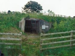
The site is the outcrop of an ENE-striking, sulphidic quartz vein, about 1m in thickness, hosted by Dalradian psammites. The Sheep Dip vein was one of the first auriferous bedrock occurrences discovered by Ennex International Ltd. in the early 1980s during mineral exploration of their licence area in the Sperrins (Clifford et al., 1990; Clifford et al., 1992). Subsequently at least 16 vein structures were found by intensive exploration involving float sampling, geophysical and geochemical surveys, trenching and drilling in the Curraghinalt area.
 | |
| Description: | |
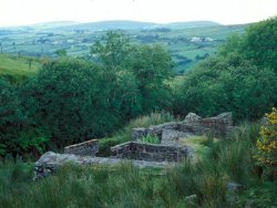
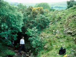
The site is located approximately 150m upstream of the Attys Bridge in the Curraghinalt Burn, which forms the boundary between Attagh and Curraghinalt Townlands 8km east of Gortin.
  | |
| Importance: | |
The Sheep Dip vein was one of the first bedrock occurrences of potentially economic gold mineralization discovered during commercial mineral exploration in Northern Ireland. It is representative of the 'lode gold' style of mineralization in the Curraghinalt prospect, which has been the subject of detailed geological and geochemical investigations widely reported in the international scientific literature. | |
| Interpretation: | |
Evidence from mineralogical studies and cathodoluminescence microscopy (Earls et al., 1996; Parnell et al., 2000; Wilkinson et al., 1999) indicates that several stages of cross-cutting quartz (Q2-Q4) were introduced during brittle deformation following early veining (Q1) formed by defluidization during ductile deformation and metamorphism of the Dalradian host rocks. Volumetrically minor, early paragenetic (Q2) electrum is encapsulated within pyrite. However, most electrum occurs along pyrite crystal boundaries, or is related to cross-cutting fractures that also contain barite, chalcopyrite, tetrahedrite, quartz and dolomite, that were formed during a secondary mineralising event (Q4). In one sample which was the subject of detailed study, the syn-pyrite and post-pyrite electrum have a different chemistry: earlier electrum has a lower silver content than that in cross-cutting veinlets. Volumetrically minor amounts of gold-bearing tellurides containing up to 5.9 at% Au were also observed as micron-scale crystals enclosed within pyrite. The most common is bismuth telluride, less common are gold-silver tellurides including hessite [Ag,Au]2Te, mercury telluride and the lead telluride, altaite [PbTe]. Those involved in the gold metallogeny study (Earls et al., 1996; Parnell et al., 2000; Wilkinson et al., 1999) concluded that paragenetically early mineralization at Curraghinalt (Q2 and associated minerals) is Ordovician in age. These minerals were deposited by fluids of magmatic origin associated with the underthrusted Tyrone Volcanic Group pyroclastic and intrusive sequence. The barren Q3 veining occurred as these fluids mixed with lower temperature, lower salinity connate waters. Q4 and associated minerals - notably, the bulk of the electrum - seem likely to have precipitated during the Carboniferous from high salinity fluids (perhaps basinal brines) that penetrated into the Dalradian metasedimentary pile during tensional tectonism associated with the Variscan Orogeny. This hitherto unexpected conclusion has interesting implications as it enhances the gold prospectivity of Carboniferous and other Upper Palaeozoic rocks in the north of Ireland. | |
| Conclusions: | |
This locality is unimpressive except for professional geologists, for whom it is important as a representative of an internationally known gold prospect and of regional metallogeny. | |
| Notes: | |
This site is complementary to Key Site 522 - Rylagh Burn. See also SLNCI Key Site 722 - Curraghinalt. | |
| Keywords | |
|---|---|
| Minerals: | Gold, Pyrite, Quartz |
| Rocks: | Psammite |
| Structures: | hydrothermal vein |
| Measurements | |||||
|---|---|---|---|---|---|
| Length: | Width: | 1m | Height: | ||
| Depth: | Area: | ||||
| Access | |
|---|---|
| Approach: | Access to the site is via a field gate into a pasture field on the east side of Attys Bridge. A wire fence separates this field from the heath adjacent to the site. |
| Management: | |
Access to the site is via a field gate into a pasture field on the east side of Attys Bridge. A wire fence separates this field from the heath adjacent to the site. Should mining activity start at the prospect, the site and other vein exposures may be excavated or become inaccessible, though the mining company could be required to leave an accessible exposure when they have completed extraction operations. Aside from this possibility, the main threat to conservation of the site is from activities of the landowner, such as burial by rubble or agricultural waste. Approval for designation of the Sheep Dip vein outcrop was agreed verbally with Mr Garth Earls on behalf of Ennex in June 1997. | |
| Threats: | The main threat to conservation of the site is from activities of the landowner, such as burial by rubble or agricultural waste. Should mining activity start at the prospect, the site and other vein exposures may be excavated or become inaccessible. |
| Uses | |
| Uses: | The immediate vicinity of the site is upland heath used for sheep grazing. North of the sheep dips is improved pasture used for sheep and cattle grazing. |
| Map(s): | OSNI 1:50,000 sheet 13; 1:10,000 sheet XX. | ||
| Record type: | ESCR report | Recorded by: | R. Nawaz and N.R. Moles |
| Entered by: | E M Porter | ||
| Last updated: | 07 MAY 68 | ||
| Enlander, I., Dempster, M. & Doughty, P., 2026. Curraghinalt Burn, near Gortin, County Tyrone, site details. [In] Earth Science Conservation Review. https://www.habitas.org.uk/escr/site.php?item=521. Accessed on 2026-11-06. |
| Previous Site | Next Site |