
| Previous Site | Next Site |
Earth Science Conservation Review
| Hill's Port, The Gobbins, Island Magee - Mineralogy | Antrim |
| Site number: | 527 | ||
| ESCC: | EC | ||
| Locality Type: | Coastal section, Roadside section | Status: | ASSI |
| Grid Reference: | J485971 Approximate | ||
| Google maps: | 54.80019,-5.69078 | ||
| County: | Antrim | Council area: | Mid & East Antrim Borough Council |
| Period: | Tertiary | ||
| Lithostrat: | Antrim Lava Group, Lower Basalt Formation | ||
| Site Description | |
|---|---|
 | |
| Highlights: | |
Roadcut and sea-cliff exposures of amygdaloidal basalt containing unusual zeolite minerals. | |
| Introduction: | |
Zeolite-bearing basalts are prone to weathering and consequently useful sites are mostly confined to coastal exposures and active quarries, where erosion and extraction expose fresh material. Hill’s Port at the south end of The Gobbins cliffs on Island Magee, is of particular interest as it is the type locality for the zeolite mineral gobbinsite. | |
| Description: | |
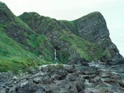
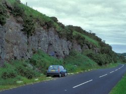 The shore at Hill’s Port is accessible on foot. The Gobbins cliff and waterfall form impressive features north of Hill’s Port. 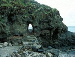 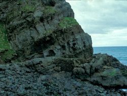 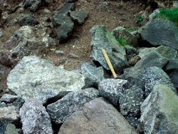 | |
| Importance: | |
Although analcime-zone zeolite-bearing basalts are widely distributed in County Antrim, Hill’s Port provides a reasonably accessible site where specimen material is abundant. The zeolite minerals gobbinsite (named after The Gobbins cliffs) and gonnardite are of restricted occurrence elsewhere. | |
| Interpretation: | |
Zeolite minerals are alkali-bearing aluminosilicates that contain chemically-bound water molecules (Tschernich, 1992). Their occurrence in amygdales is characteristic of flood basalt lava piles such as the British Tertiary Province and Iceland. Walker (1960 and earlier papers) studied the distribution of zeolite mineral species in the lava piles of Ireland and Iceland, and was the first to demonstrate that zeolite mineralogy related to (a) rock type i.e. whether the host basalt is olivine-bearing or tholeiitic, and (b) depth in the lava pile, i.e. the temperature attained during hydrothermal alteration. The zeolite mineral assemblage at Hill’s Port is characteristic of olivine basalt alteration within the scolecite-mesolite zone (Walker, 1960), whereas the roadcut exposures are probably within the topographically higher (lower temperature) analcime zone. | |
| Conclusions: | |
This area is strongly recommended for site designation as it is of mineralogical and historical interest, is reasonably accessible, and is an area of spectacular coastal scenery. | |
| Notes: | |
See also SLNCI Key Site 755 - Hill's Port, The Gobbins. | |
| Keywords | |
|---|---|
| Minerals: | Analcime, Analcite, Calcite, Chabazite, Gobbinsite, Natrolite, Zeolites, Heulandite, Levyne, Cowlesite, Mesolite, Gonnardite, Travertine |
| Rocks: | Amydaloidal Basalt, Olivine Basalt |
| Structures: | amygdales |
| Access | |
|---|---|
| Approach: | Hill's Port is accessed via the path from the private untarred road to Gobbins Cottage. |
| Management: | |
Natural processes of erosion and landslip will ensure a supply of fresh zeolite-bearing basalt. The main threats are over-zealous collectors, and modification of the shoreline if the Gobbins Path is reconstructed. Although the path is accessible for c.250m beyond the entrance tunnel, in several sections it is hazardous and unsafe in all but the calmest conditions. For this reason it would be undesirable to encourage visitors to the area, unless warning signs and perhaps a barrier were erected beyond the area of mineralogical interest and before the hazardous sections of the Gobbins path. | |
| Threats: | The main threats are over-zealous collectors and modification of the shoreline if the Gobbins Path is reconstructed. |
| Uses | |
| Uses: | Intertidal zone accessed via path from the private untarred road to Gobbins Cottage. |
| Map(s): | OSNI 1:50,000 sheet 9. | ||
| Record type: | ESCR report | Recorded by: | R. Nawaz and N.R. Moles |
| Entered by: | E M Porter | ||
| Last updated: | 07 MAY 68 | ||
| Enlander, I., Dempster, M. & Doughty, P., 2026. Hill's Port, The Gobbins, Island Magee - Mineralogy, County Antrim, site details. [In] Earth Science Conservation Review. https://www.habitas.org.uk/escr/site.php?item=527. Accessed on 2026-11-06. |
| Previous Site | Next Site |