
| Previous Site | Next Site |
Earth Science Conservation Review
| Carneal, Glenoe | Antrim |
| Site number: | 528 | ||
| ESCC: | ED | ||
| Locality Type: | Quarry (disused) | Status: | ASSI |
| Grid Reference: | J390959 Centroid | ||
| Google maps: | 54.79214,-5.83896 | ||
| County: | Antrim | Council area: | Mid & East Antrim Borough Council |
| Period: | Tertiary, Cretaceous | ||
| Lithostrat: | Antrim Lava Group, Lower Basalt Formation, Ulster White Limestone Formation | ||
| Site Description | |
|---|---|
 | |
| Highlights: | |
Calc-silicates associated with Tertiary dolerite plug intruded into Ulster White Limestone. | |
| Introduction: | |
 | |
| Description: | |
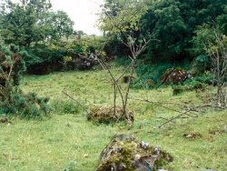
The geological features of this locality, known as Carneal Plug, were described by Wilson (1960) and briefly in the field guide by Emeleus and Preston (1969, p.9). The dolerite plug (not marked on the GSNI 1:250,000 sheet) intrudes the Lower Basalt Formation but has dragged up a block of Cretaceous limestone (Chalk) from depth. This limestone has been metamorphosed to marble, which was worked in the small quarry. A boulder of granular white marble occurs amongst gorse bushes just north of the quarry floor. The margins of the limestone block were altered to calc-silicate rock containing spurrite and other minerals, while the adjoining dolerite was altered by the assimilation of limestone resulting in formation of coarse, black pyroxenite and mixed pyroxene-larnite rocks.
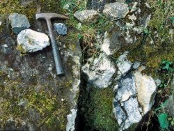 The following minerals were found in material from the area: calcite, larnite, spurrite, bredigite, melilite, spinel, titanaugite, wollastonite and the brown gel-like alteration product plombierite. Tobermorite is also reported from the locality. To the authors’ knowledge, no detailed study of the petrology and mineralogy of the contact metasomatic rocks has been published. | |
| Importance: | |
Carneal is one of a small number of important mineralogical sites featuring calc-silicate mineral assemblages, which were first described by Tilley and co-authors in the 1930s from Scawt Hill (Tilley and Harwood, 1931). At Carneal, rocks that are similar in mineralogy to Scawt Hill (see Key Sites 536 and 1130) can be found, but the field relationships are presently less clear as the quarry is overgrown. However, it is a much more accessible locality than Scawt Hill and is suitable for educational visits. | |
| Conclusions: | |
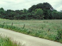
We recommend that the disused quarry and adjoining woodland extending southwest from the farm lane to the Carneal Water should be designated for conservation. | |
| Keywords | |
|---|---|
| Minerals: | Bredigite, Calcite, Larnite, Melilite, Plombierite, Spinel, Spurrite, Wollastonite, Titanaugite, Tobermorite |
| Rocks: | Basalt, Dolerite, Limestone, Marble |
| Structures: | plug |
| Access | |
|---|---|
| Approach: | A gate facilitates access into the quarry. Permission should be sought from the landowner. |
| Management: | |
Recommended management actions: (a) agree access with landowner, (b) remove moss that obscures outcrops in the quarry, and (c) consider removing fill material from the quarry floor to improve exposures of the marble bedrock. | |
| Uses | |
| Uses: | Deciduous woodland and pasture farmland used for grazing cattle. |
| Map(s): | OSNI 1:50,000 sheet 9. | ||
| Record type: | ESCR report | Recorded by: | R. Nawaz and N.R. Moles |
| Entered by: | E M Porter | ||
| Last updated: | 07 MAY 68 | ||
| Enlander, I., Dempster, M. & Doughty, P., 2026. Carneal, Glenoe, County Antrim, site details. [In] Earth Science Conservation Review. https://www.habitas.org.uk/escr/site.php?item=528. Accessed on 2026-11-06. |
| Previous Site | Next Site |