
| Previous Site | Next Site |
Earth Science Conservation Review
| Craigahulliar Quarry - Mineralogy | Antrim |
| Site number: | 534 | ||
| ESCC: | ED | ||
| Locality Type: | Quarry (disused) | Status: | ASSI |
| Grid Reference: | C882389 Centroid | ||
| Google maps: | 55.18977,-6.61518 | ||
| County: | Antrim | Council area: | Causeway Coast & Glens Borough Council |
| Period: | Tertiary | ||
| Stages: | Eocene, Palaeocene | ||
| Lithostrat: | Antrim Lava Group, Interbasaltic Formation, Lower Basalt Formation | ||
| Site Description | |
|---|---|
 | |
| Highlights: | |
Tertiary basalt with zeolite minerals. | |
| Introduction: | |
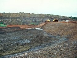
Craigahulliar (sometimes written as Craignahulliar) is a large former quarry located 3km SE of Portrush. It was worked by Portrush Columnar Basalt Company Ltd. until the 1980s. Having been disused for several years, the quarry was purchased by Coleraine Borough Council who in the early 1990s obtained planning permission for a municipal waste landfill operation. Phase 1 of the site development commenced in July 1997 and is expected to be completed in 2001. This development included extensive civil engineering works in the quarry and installation of a liner generating a void space of 0.25 million cubic metres. Further development to generate a capacity of 1.3 million m3 is planned and the landfill is expected to operate over a 25 year period. In April 1998, geological features in the former quarry were designated a Geological ASSI, and Coleraine Borough Council have collaborated with the EHS to preserve significant features within the site and to maintain public access to them. Craigahulliar is part of a regional geological trail (Lyle, 1996), and an interpretive centre located near the former quarry entrance was opened in 1999. | |
| Description: | |
Black (1976) published a short paper on the unusual occurrence of chalcedony and quartz in the tholeiitic basalt at Craigahulliar. More recently, geological features of the site have been described by Paul Lyle in his excursion guide published by the EHS in 1996 (pages 49-52) (see also Key Site 65 - Craigahulliar Quarry). Lyle’s localities 1, 2a, 2b and 4 have been preserved but not locality 3 (the eastern wall of the main quarry). Brief reference is made here to the mineralogical interest at these localities. At locality 1, overlying the well-exposed Interbasaltic Formation is the first flow of the Causeway lavas, which in the lower portion contains pipe vesicles filled with chalcedony. This is an unusual occurrence in Antrim. Specimens of chalcedony showing stalactitic growth and layering within vesicles were in the past abundant elsewhere in the former quarry, but these exposures have been removed or buried by the landfill development. At locality 2, exposures of a higher stratigraphical level in this lava flow contain amygdaloidal zones from which specimens of calcite and the zeolite minerals phacolite (a variety of chabazite), chabazite, phillipsite and analcime can be obtained. During a site visit in 1997, abundant loose material had been placed by the landfill development operation near locality 2b, and this also contained zeolite-bearing basalt. However, this material is ephemeral in that it weathers quickly over a few years. 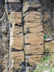 | |
| Notes: | |
See also Key Site 65 - Craigahulliar Quarry. | |
| Keywords | |
|---|---|
| Minerals: | Analcime, Calcite, Chabazite, Chalcedony, Phillipsite, Zeolites, Phacolite |
| Rocks: | Basalt, Tholeiite |
| Structures: | amygdales, pipe vesicle |
| Access | |
|---|---|
| Approach: | The quarry is 3 km south-east of Portrush. Access to localities is via the quarry road from Ballycraig Upper. |
| Management: | |
Former quarry now a landfill site with managed access. | |
| Uses | |
| Uses: | Landfill site. |
| Record type: | ESCR report | Recorded by: | R. Nawaz and N.R. Moles |
| Entered by: | E M Porter | ||
| Last updated: | 07 MAY 68 | ||
| Enlander, I., Dempster, M. & Doughty, P., 2026. Craigahulliar Quarry - Mineralogy, County Antrim, site details. [In] Earth Science Conservation Review. https://www.habitas.org.uk/escr/site.php?item=534. Accessed on 2026-11-06. |
| Previous Site | Next Site |