
| Previous Site | Next Site |
Earth Science Conservation Review
| Larkhill - Mineralogy | Fermanagh |
| Site number: | 542 | ||
| ESCC: | EO | ||
| Locality Type: | Road cutting, Spoil heaps | Status: | ASSI |
| Grid Reference: | H008639 Centroid | ||
| Google maps: | 54.52394,-7.98762 | ||
| County: | Fermanagh | Council area: | Fermanagh & Omagh District Council |
| Period: | Precambrian | ||
| Lithostrat: | Slishwood Division, Lough Derg Psammite Formation | ||
| Site Description | |
|---|---|
 | |
| Highlights: | |
Feldspar-rich pegmatites containing orthoclase, muscovite and quartz, formerly worked for pottery production. | |
| Introduction: | |
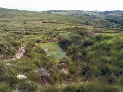
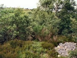
Around 100 years ago pegmatite mining was undertaken in the Larkhill area to supply raw material for pottery production at Belleek. Feldspar-rich pegmatites, hosted by the Lough Derg Psammite Formation (formerly regarded as ‘Moine’, now the Slishwood Division), occur in outcrop and as spoil material associated with former shallow mines in this area. | |
| Description: | |
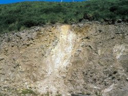
The best exposure is located in Scardans Upper Townland, close to Crassowen river, at a recently-quarried roadcut on the private access road to a farmhouse owned (in 1997) by Vincent O’Connor (GR 201 100, 364 000).
  | |
| Notes: | |
See also Key Site 127 - Larkhill. | |
| Keywords | |
|---|---|
| Minerals: | Muscovite, Orthoclase, Quartz |
| Rocks: | Pegmatite, Psammite |
| Access | |
|---|---|
| Management: | |
The site is of historical interest. The unfilled pits and adjacent spoil heaps are hazardous, but are relatively inaccessible and the landowner should be encouraged to preserve these remains. The roadcut provides an accessible bedrock exposure of a pegmatite vein and this exposure should be maintained. | |
| Uses | |
| Uses: | Scrub and woodland. |
| Record type: | ESCR report | Recorded by: | R. Nawaz and N.R. Moles |
| Entered by: | E M Porter | ||
| Last updated: | 07 MAY 68 | ||
| Enlander, I., Dempster, M. & Doughty, P., 2026. Larkhill - Mineralogy, County Fermanagh, site details. [In] Earth Science Conservation Review. https://www.habitas.org.uk/escr/site.php?item=542. Accessed on 2026-11-06. |
| Previous Site | Next Site |