
| Previous Site | Next Site |
Earth Science Conservation Review
| Milltown, Strabane | Tyrone |
| Site number: | 544 | ||
| ESCC: | EM | ||
| Locality Type: | Adit | Status: | local interest |
| Grid Reference: | H351967 Approximate | ||
| Google maps: | 54.81735,-7.45398 | ||
| County: | Tyrone | Council area: | Derry City & Strabane District Council |
| Lithostrat: | Newtownstewart Formation | ||
| Site Description | |
|---|---|
 | |
| Highlights: | |
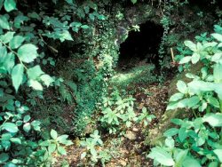
Former lead trial adits with in situ galena-bearing vein. | |
| Introduction: | |
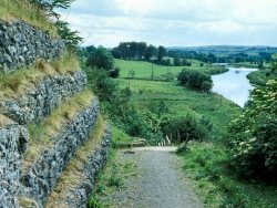
The locality is on the east bank of the River Mourne 1km upstream of Strabane Bridge. A path descends to the bank of the river from opposite the entrance to Milltown House (Strabane Grammar School). The heavily overgrown entrance to the mine trial is located 10m from the bottom of steps where this path ascends to below the road. | |
| Description: | |
 | |
| Importance: | |
One of many small nineteenth century lead trials, however this has significance in the context of the regional metallogeny of NW Northern Ireland (Earls et al., 1996) and is highly accessible due to its location close to a public path, a school and a town. | |
| Keywords | |
|---|---|
| Minerals: | Galena, Gold, Pyrite, Quartz |
| Rocks: | Quartzite |
| Structures: | hydrothermal vein |
| Access | |
|---|---|
| Management: | |
Clearance of vegetation and mud and perhaps laying a path to the adits would allow the site to be reached more easily. An interpretative board should be considered. |
| Record type: | ESCR report | Recorded by: | R. Nawaz and N.R. Moles |
| Entered by: | E M Porter | ||
| Last updated: | 07 MAY 68 | ||
| Enlander, I., Dempster, M. & Doughty, P., 2026. Milltown, Strabane, County Tyrone, site details. [In] Earth Science Conservation Review. https://www.habitas.org.uk/escr/site.php?item=544. Accessed on 2026-11-06. |
| Previous Site | Next Site |