
| Previous Site | Next Site |
Earth Science Conservation Review
| Mournes - Ben Crom | Down |
| Site number: | 1100 | ||
| ESCC: | EO | ||
| Locality Type: | Crag, Crags | Status: | ASSI |
| Grid Reference: | J311259 Centroid | ||
| Google maps: | 54.16583,-5.99272 | ||
| County: | Down | Council area: | Newry, Mourne & Down District Council |
| Period: | Tertiary | ||
| Stages: | Eocene | ||
| Lithostrat: | Granite | ||
| Site Description | |
|---|---|
 | |
| Highlights: | |
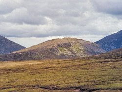
Crags just below the summit of Ben Crom in the Eastern Mournes show the roof contact of the Aplitic Granite G3 under the laccolithic top of the G2 ring-dyke. | |
| Introduction: | |
The 1" Geological Survey map (sheet 60) (1901) depicts this internal contact as the boundary of a considerable mass of aplite (elvanite). Richey (1928), however, found that this aplite grades downhill into the Aplitic Granite. | |
| Description: | |
The mountains of the Eastern Mournes expose both wall and roof contacts of the granite ring-dyke intrusions. On Ben Crom the flat lying/roof contact between the G2 and G3 intrusions is clearly displayed in cliff section and can be traced laterally from the SW shoulder around the S face of the mountain to less accessible exposures in the precipitous cliffs overlooking the Ben Crom Reservoir. The Quartzose Granite shows well developed mural jointing in a coarse-grained rock. The contact with G3
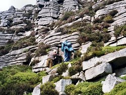 The contact can be seen to dip gently westwards along the line of crags and wide clefts in the cliffs demonstrate its flat nature to the north. Granite crags at the summit of Ben Crom are traversed by both basic and feldspar porphyry dykes. | |
| Importance: | |
A fine exposure of the G2/G3 roof contact and one which is easy to reach. | |
| Interpretation: | |
The existence of a contact between the G2 and G3 Granites separates in time and space two rock bodies which are not geochemically distinctive but which show considerable textural variation. The disposition of this internal boundary supports the structural interpretation of the Mourne Granites as ring-dyke intrusions with laccolithic tops. Sub-surface cauldron subsidence allowed granitic magma to well up the annular space around the foundering block of country rock and fill the cavity above it. Repeated subsidence over the Eastern Mourne centre put granite in contact with granite, the younger intrusions emplaced within and below the earlier ring-dykes. | |
| Conclusions: | |
A somewhat remote locality but because of the nature of the exposure, its accessibility and clarity, is worthy of conservation. The disused quarry in G3 which overlooks the Mill River just downstream from the Ben Crom Dam is worth including in the proposed site; it has yielded beryl-bearing segregations in the past. | |
| Notes: | |
The disused quarry in G3 which overlooks the Mill River just downstream from the Ben Crom Dam has yielded beryl-bearing segregations in the past. For Mourne Granites general information and reference list see; Key Site 1129 - The Granites - Overview. For general information on the cone-sheet intrusions associated with the Mourne Granites, and the Mourne Mountain dyke swarm, see; Key Site 1131 - Cone-sheet and Dyke Swarm - Overview. | |
| Keywords | |
|---|---|
| Rocks: | Granite, Pegmatite, Porphyry |
| Structures: | ring-dyke |
| Relations: | Contact, Intrusion |
| NonGeol: | Sheep grazing, hill walking. |
| Access | |
|---|---|
| Approach: | Access could be made via the road to Ben Crom Dam which terminates in the old quarry, followed by a steep ascent up the S shoulder of Ben Crom. Alternatively the visitor could use the track from the road beside Fofanny Reservoir, Irish Grid Reference J280279, which crosses the Mourne Wall between Carn Mountain and Slieve Loughshannagh and follows the headwaters of the Ben Crom River to the line of crags under Ben Crom itself. |
| Threats: | Too much sampling at in situ contact will disfigure the site. |
| Map(s): | Richey's map (1928) and the 1:50000 Geological Survey map of the Mourne Mountains (1978) pinpoint the locality and place it in the context of the G3 intrusion as a whole. | ||
| Record type: | ESCR report | ||
| Entered by: | E M Porter | ||
| Enlander, I., Dempster, M. & Doughty, P., 2026. Mournes - Ben Crom, County Down, site details. [In] Earth Science Conservation Review. https://www.habitas.org.uk/escr/site.php?item=1100. Accessed on 2026-11-06. |
| Previous Site | Next Site |