
| Previous Site | Next Site |
Earth Science Conservation Review
| Mournes - Bloody Bridge River Section | Down |
| Site number: | 1104 | ||
| ESCC: | EO | ||
| Locality Type: | Stream section | Status: | ASSI |
| Grid Reference: | J387270,J373268 End(s) of linear site, Not Entered | ||
| Google maps: | 54.17371,-5.87594 | ||
| County: | Down | Council area: | Newry, Mourne & Down District Council |
| Period: | Tertiary, Silurian | ||
| Stages: | Eocene, Silurian Undifferentiated | ||
| Lithostrat: | Granite | ||
| Site Description | |
|---|---|
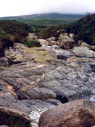 | |
| Highlights: | |
An almost continuous section across the outer and some inner contacts of the Eastern Mourne Granites. | |
| Introduction: | |
Hornfelsed Silurian rocks can be found in contact with the outer granite G2 and a screen of hornfels within the granite separates successive pulses of G2. Richey (1928) mapped out the boundaries of both the outer and inner Feldspathic granite, G1' and G1 respectively separated by the hornfels screen. Meighan (1976), on geochemical evidence, incorporated all the ring-dyke outcrops of G1 as part of the Quartzose Granite. | |
| Description: | |
Hood (1982) offers the most detailed account of the geology of this Bloody Bridge River section. Typical Silurian Hornfels crops out in the stream bed and banks from the shore to a point some 150m below the confluence with the Glen Fofanny River. The Silurian rocks consist mainly of laminated slates with alternating greenish and purplish coloured layers. Thermal metamorphism against the granite has changed them into diopsidic and biotitic hornfelses. The Caledonoid trend of the country rock seems unaffected by the proximity of the granite, a consequence of passive emplacement of the granitic magma. Just upstream from the road bridge an old course of the river is surmounted by spectacular sections through a lateral moraine. At some 230m further upstream where the course of the river divides, a small, vertical, basic intrusion striking N cuts the hornfels, and where the courses recombine further upstream again a 46cm wide basic dyke follows the stream bed, dipping steeply to the S. Near the contact 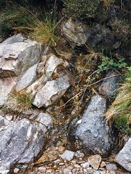 The granite is variable in its grain-size and texture within 100m of the wall rocks. A slightly porphyritic microgranite occurs at the vertical junction with the Silurian; upstream the microgranite gradually coarsens, 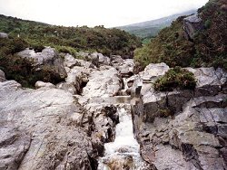 Above the confluence with the Glen Fofanny River the coarse-grained G2 is intruded by irregular apophyses of porphyritic microgranite; these are more extensively exposed in the tributary stream to the N. Kaolinised granite is also recorded. 230m above the confluence a narrow gorge marks the presence of a steeply dipping screen of hornfels within G2; it is circa 30m wide; its eastern margin is vertical and its western margin dips W at 73 deg. 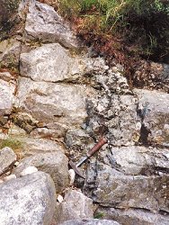 A small quarry 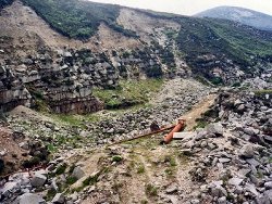 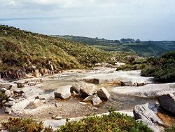 Upstream from this disused quarry Hood (1981) records a mafic facies along the inner margin of the outer G2 pulse; its occurrence is pictured in Meighan et al (1984). | |
| Importance: | |
The best exposed and best known section through the outer margin of G2. The screen crops out in the Glen Fofanny River and to the S in the Crock Horn Stream and Spences River but the sections are not as spectacular. The only known example of mineral layering among the Mourne granites was discovered as a boulder of G1 in the bed of the Bloody Bridge River; a slice is on display in the Geology Department of the Queen's University. Its source has not been found but probably lies in the vicinity (Meighan 1979). From the foot of this section and on a clear well lit day, one can trace the G1/G2 contact on Slieve Donard by the contrasting colours of grey above cream! | |
| Interpretation: | |
The steep outer contact of the granite is in agreement with Richey's ring-dyke / cauldron subsidence mechanism for its emplacement. The hornfels screen supports this hypothesis and suggests large scale spalling from the subsiding block of country rock probably concomitant with a renewed pulse of G2 magma into the ring fracture. The presence of late-stage apophyses marks the progressing differentiation of the initial melt, and the Kaolinization the effect of late stage fluids escaping from deeper-seated volumes of the granite magma. | |
| Conclusions: | |
The site offers an almost continuous section through the ring-dyke structure of the Quartzose Granite, illustrating the nature of both external and internal contacts. The stream section in its entirety from source to mouth could be considered for conservation. | |
| Notes: | |
For Mourne Granites general information and reference list see; Key Site 1129 - The Granites - Overview. For general information on the cone-sheet intrusions associated with the Mourne Granites, and the Mourne Mountain dyke swarm, see; Key Site 1131 - Cone-sheet and Dyke Swarm - Overview. | |
| Keywords | |
|---|---|
| Minerals: | Biotite, Diopside |
| Rocks: | Granite, Hornfels, Porphyry |
| Structures: | ring-dyke |
| Relations: | Contact, Intrusion |
| NonGeol: | Heath land for sheep grazing. Mourne aquaduct pipi |
| Measurements | |||||
|---|---|---|---|---|---|
| Length: | 1400m | Width: | Height: | ||
| Depth: | Area: | ||||
| Access | |
|---|---|
| Approach: | Access is readily made along the whole length of the river section from the tourist path which follows the left bank from the road bridge to the col south of Slieve Donard. Flood water will hide the exposures at times. |
| Map(s): | For essential geology of the Bloody Bridge River section see the 1 inch geological map of the Mourne Mountains (1978). For a detailed map see Hood (1982). | ||
| Record type: | ESCR report | ||
| Entered by: | E M Porter | ||
| Enlander, I., Dempster, M. & Doughty, P., 2026. Mournes - Bloody Bridge River Section, County Down, site details. [In] Earth Science Conservation Review. https://www.habitas.org.uk/escr/site.php?item=1104. Accessed on 2026-11-06. |
| Previous Site | Next Site |