
| Previous Site | Next Site |
Earth Science Conservation Review
| Mournes - Eagle Rock | Down |
| Site number: | 1105 | ||
| ESCC: | EO | ||
| Locality Type: | Cliff, Crag, Crags | Status: | ASSI |
| Grid Reference: | J358284 Centroid | ||
| Google maps: | 54.18705,-5.91968 | ||
| County: | Down | Council area: | Newry, Mourne & Down District Council |
| Period: | Tertiary, Silurian | ||
| Stages: | Eocene, Silurian Undifferentiated | ||
| Lithostrat: | Granite | ||
| Site Description | |
|---|---|
 | |
| Highlights: | |
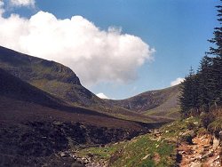
This site is located at the roof-zone of the Quartzose Granite G2 where the earlier Feldspathic Granite G1 is in steep contact with the hornfelsed Silurian rock. | |
| Introduction: | |
On the N and NNE slopes of Slieve Donard, Richey (1928) mapped in the laccolithic top to the first granite ring-dyke of the Mourne Centre: two other occurrences cap the mountains of Slieve Commedagh and Slieve Corragh to the W. Above Eagle Rock this Feldspathic Granite is in contact with its own wall rock, the hornfelsed Silurian. In addition the Quartzose Granite G2, which underlies this roof of G1 and hornfels is drusy and has yielded to Richey (1928), the iron-olivine, fayalite, an occurrence which has not been confirmed by later workers. Hood (1981) following Meighan (1976) remapped this area and revised the boundaries of the G1 and G2 ring-dykes. | |
| Description: | |
Plate LII in Richey's (1928) paper on the structural relations of the Mourne Granites illustrates a section drawn through the summit of Slieve Donard and Thomas's Mountain to the NNE. Here the Feldspathic Granite G1, in vertical contact with the Silurian hornfels, rests on top of the Quartzose Granite G2. The contact is flat lying with a gentle dip to the N; to the SE near Chimney Rock, however, Richey draws this same junction between G2 and G1 as near vertical following the inner boundary of the first ring-dyke with its laccolithic top. Meighan's geochemical correlations (1976) clearly demonstrate that the dyke-like part of Richey's G1 is but an early pulse of the G2 magma and the downward extension of G1 is not exposed. | |
| Importance: | |
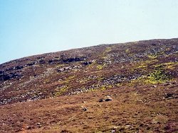
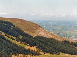
Eagle Rock itself, offers an excellent section of the G1/G2 contact while the region as a whole, including Thomas's Mountain
  | |
| Interpretation: | |
The exposed contacts support Richey's (1928) claim for passive emplacement of the granites by subsurface cauldron subsidence. | |
| Notes: | |
For Mourne Granites general information and reference list see; Key Site 1129 - The Granites - Overview. For general information on the cone-sheet intrusions associated with the Mourne Granites, and the Mourne Mountain dyke swarm, see; Key Site 1131 - Cone-sheet and Dyke Swarm - Overview. | |
| Keywords | |
|---|---|
| Rocks: | Granite, Hornfels |
| Structures: | drusy, ring-dyke |
| Relations: | Contact, Intrusion |
| NonGeol: | Sheep grazing, outdoor pursuits. |
| Access | |
|---|---|
| Approach: | A well kept footpath follows the Glen river from the Donard Park to the saddle between Slieve Donard and Slieve Commedagh. |
| Restrictions: | None apparent |
| Map(s): | The relevant geology is shown on the 1:25000 Mourne Country O.S. Map. | ||
| Record type: | ESCR report | ||
| Entered by: | E M Porter | ||
| Enlander, I., Dempster, M. & Doughty, P., 2026. Mournes - Eagle Rock, County Down, site details. [In] Earth Science Conservation Review. https://www.habitas.org.uk/escr/site.php?item=1105. Accessed on 2026-11-06. |
| Previous Site | Next Site |