
| Previous Site | Next Site |
Earth Science Conservation Review
| Mournes - Green Harbour Dyke No. 55 | Down |
| Site number: | 1112 | ||
| ESCC: | EF | ||
| Locality Type: | Coastal section | Status: | ASSI |
| Grid Reference: | J388248 Centroid | ||
| Google maps: | 54.15393,-5.87542 | ||
| County: | Down | Council area: | Newry, Mourne & Down District Council |
| Period: | Tertiary | ||
| Stages: | Eocene | ||
| Lithostrat: | Granite | ||
| Site Description | |
|---|---|
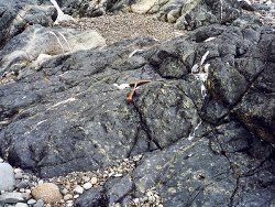 | |
| Highlights: | |
Occurrence of a multiple and composite dyke. | |
| Introduction: | |
Basic and intermediate dyke rocks occupy the same fissure; the latter shows a variolitic (chill) texture, which is common among the Mourne dykes, an amygdaloidal structure, and carries xenocrysts derived from a deeper acid igneous rock. | |
| Description: | |
Tomkeieff and Marshall (1935) give a detailed description and geological map of this multiple and composite dyke which they labelled No.55. The first member emplaced in the fissure was an olivine dolerite; it is some 3-8 m wide and can be seen along the northern contact which shows an offset to the north lower down the beach. Olivine is sparse and mostly altered, plagioclase laths are labradoritic to basic andesine in composition and in ophitic intergrowth with a somewhat titaniferous augite. Chlorite is an alteration product of pyroxene, and ilmenite and magnetite are accessory minerals. A macrovesicular variolite, 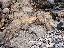 A final intrusion of a xenoporphyritic variolite, 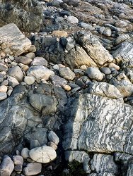 A crush zone traverses Dyke No.55 and makes offsets in both its outer contacts. Northwards the crush affects a fine-grained basic igneous rock carrying amygdales and showing possible internal contacts. The crushed rock truncates thin veins of dolerite and to the north becomes associated with a massive light-coloured felsite. Some 80-100 m north of Dyke No.55 this felsite shows fine-grained basic margins on either side; both felsite/dolerite and dolerite/hornfels contacts are vertical and trend NNE. This intrusion is probably another expression of the cone sheet seen at Glasdrumman Port and Bloody Bridge. It is not listed by Tomkeieff and Marshall (1935), nor is it shown on the one-inch Geological Map of the Mourne Mountains, but Cole (1894) mentions such an occurrence of andesite and eurite at Green Harbour which is probably the same intrusion. | |
| Importance: | |
A fine example of repeated intrusion of basic and intermediate magma into the one fissure. The rocks are representative of many other members of the Mourne dyke swarm. The nature and sequence of intrusion offers some insight into deeper seated vulcanism beneath the Mourne area. | |
| Interpretation: | |
Reopening of the same fissure has brought into juxtaposition early and probably undifferentiated basic rock, and somewhat more differentiated rocks of slightly lower specific gravity which carry hornblende as a primary ferromagnesian mineral. The variolitic texture is probably a result of rapid cooling of the magma. The vesicular nature points to free degassing of the rock-melt as it moved towards the Tertiary surface. The xenocrysts and xenoliths would appear to be derived from an acid igneous rock; one can only speculate on its nature. Corrosion features around these foreign crystal and rock fragments could indicate their incorporation at greater depth. | |
| Notes: | |
The dyke is well exposed at the head of the beach below HWM. Further down the beach cobbles and boulders obscure the outcrop. Landslip from the moraine above the beach may temporarily cover the exposure but the sea would eventually remove all but the largest boulders. Storm and/or spring tides may redistribute the beach sediment but it is unlikely to cover the whole outcrop of the dyke. For Mourne Granites general information and reference list see; Key Site 1129 - The Granites - Overview. For general information on the cone-sheet intrusions associated with the Mourne Granites, and the Mourne Mountain dyke swarm, see; Key Site 1131 - Cone-sheet and Dyke Swarm - Overview. | |
| Keywords | |
|---|---|
| Rocks: | Dolerite, Variolite |
| Structures: | amygdales, dyke |
| Relations: | Intrusion |
| Measurements | |||||
|---|---|---|---|---|---|
| Length: | Width: | ~9-14m | Height: | ||
| Depth: | Area: | ||||
| Access | |
|---|---|
| Approach: | Access to the beach is made from the Newcastle-Annalong road. At Irish Grid ref. J384246 a grassy path (National Trust) starts at a small conifer plantation and leads directly to the beach at Dunmore Head; traverse the beach north to Green Harbour. Dyke No.55 occurs just south of the Crock Horn Stream that flows under Ballagh Bridge. |
| Threats: | Temporary burial |
| Map(s): | Sketch maps from Plate XIX, and Fig. 7 in Tomkeieff & Marshall (1935), will suffice to locate the dyke. | ||
| Record type: | ESCR report | ||
| Entered by: | E M Porter | ||
| Enlander, I., Dempster, M. & Doughty, P., 2026. Mournes - Green Harbour Dyke No. 55, County Down, site details. [In] Earth Science Conservation Review. https://www.habitas.org.uk/escr/site.php?item=1112. Accessed on 2026-11-06. |
| Previous Site | Next Site |