
| Previous Site | Next Site |
Earth Science Conservation Review
| Slieve Gullion Ring - Glendesha Forest | Armagh |
| Site number: | 1124 | ||
| ESCC: | EO | ||
| Locality Type: | Scarp face | Status: | ASSI |
| Grid Reference: | H995171 Centroid | ||
| Google maps: | 54.09389,-6.47922 | ||
| County: | Armagh | Council area: | Newry, Mourne & Down District Council |
| Period: | Tertiary | ||
| Stages: | Palaeogene | ||
| Lithostrat: | Porphyritic Felsite, Slieve Gullion Complex | ||
| Site Description | |
|---|---|
 | |
| Description: | |
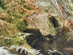
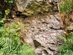
The Porphyritic Felsite ring-dyke forms the steep hillside of Slievebrack; the conspicuous scarp above the outer contact is now hidden by forest trees. Southerly dipping flow structures
 | |
| Importance: | |
A useful excursion locality demonstrating the more sheet-like structure of the ring-dyke as it invades the vent fill. | |
| Notes: | |
For reference list see; Key Site 1118 - Slieve Gullion Ring - Overview | |
| Keywords | |
|---|---|
| Rocks: | Agglomerate, Felsite, Granodiorite |
| Structures: | ring-dyke, volcanic vent |
| Relations: | Contact, Intrusion |
| Access | |
|---|---|
| Approach: | The forest lies E of the road between Carrive Grove and Mullaghbane which traverses the SW slopes of Slievebrack. |
| Map(s): | For site location see the 1:50,000 O.S. Sheet 28 (Monaghan). | ||
| Record type: | ESCR report | ||
| Entered by: | E M Porter | ||
| Enlander, I., Dempster, M. & Doughty, P., 2026. Slieve Gullion Ring - Glendesha Forest, County Armagh, site details. [In] Earth Science Conservation Review. https://www.habitas.org.uk/escr/site.php?item=1124. Accessed on 2026-11-08. |
| Previous Site | Next Site |