
| Previous Site | Next Site |
Earth Science Conservation Review
| Belmore, Ballintempo & Tullybrack Uplands; Belmore | Fermanagh |
| Site number: | 1158 | ||
| ESCC: | IC | ||
| Locality Type: | Karst | Status: | local interest |
| Grid Reference: | H1141 Approximate | ||
| Google maps: | 54.3181,-7.83095 | ||
| County: | Fermanagh | Council area: | Fermanagh & Omagh District Council |
| Period: | Quaternary, Carboniferous | ||
| Stages: | Asbian, Holocene, Visean | ||
| Lithostrat: | Carrickmacsparrow Limestone Member, Dartry Limestone Formation, Glenade Sandstone Formation, Glencar Limestone Formation, Knockmore Limestone Member, Meenymore Formation | ||
| Site Description | |
|---|---|
 | |
| Highlights: | |
The southern slopes of Belmore Mountain are composed of Lower Carboniferous limestones crossed by a major E-W fault (the Belcoo fault) and a number of N-S faults. Large areas of secondary dolomitization are associated with the Belcoo fault. There is a Tertiary dolerite dyke at the eastern end of the scarp. There are numerous small sinks within the limestone outcrop, related to streams which originate on the sandstone cap of Belmore Mountain. Associated with the sinks are many small risings. At the western end of Belmore Mountain adjacent to the eastern end of the Ballintempo upland are more small sinks (e.g. Mullyard) and a major rising at Holywell. | |
| Introduction: | |
The karst area covers 20km2 from the eastern scarp and southern slopes of Belmore Mountain to the Lurgan River valley and Holywell in the west. Numerous small streams forming on the Glenade Sandstone cap of Belmore Mountain flow south and east to sink into many sinks in the Cherty Facies of the Dartry Limestone. The underground drainage is presumed to flow through the Knockmore Limestone and resurges at the Knockmore-Glencar contact. The strata generally dip gently (~10°) to the northwest and the southern slope is heavily faulted. The Belcoo fault trends E-W and to its north are many predominantly N-S fractures. Mitchell (1983) describes the Belcoo fault and the resultant secondary dolomitization in detail. The topography of the southern slopes of Belmore consists of a gently undulating limestone bench with numerous rock exposures bounded to the north by cliffs and limestone knolls and to the south by moderate to steep slopes covered with glacial drift. There is a significant dry valley lying parallel to the slope in the Moneyouragan townland. The steep slopes of the eastern flank of Belmore are comprised mainly of Dartry Limestone and have not been affected by the intense faulting. Holywell Rising is a significant resurgence on the Belcoo fault. History of Exploration: In 1971 the Reyfad Group concentrated their exploration efforts for a short period on Belmore Mountain with little result. In 1979 members of the Group explored Mullyard Sink Cave and during the 1980's comprehensive surface investigation and mapping was undertaken by G. Burns of the Reyfad Group. Major Speleological Sites: Holywell Rising (H0761 3970). Minor Speleological Sites: Moneyouragan Pot (H1234 4075), Moneyouragan Sink (H1230 4072), Moneyouragan Cave (H1226 4070), Rahallen Sink 1 (H1431 4118), Rahallen Sink 2 (H1434 4118), Mullyard Sink (H0800 4099). Total area: ~20km2. | |
| Description: | |
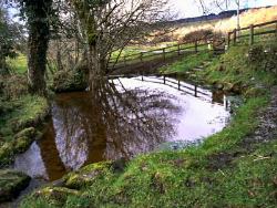
I - Hydrology No dye tracing has been completed on Belmore, Mullyard and Holywell. The surface streams forming on the sandstone cap of Belmore feed a large number of small sinks close to 250m amsl where the Meenymore - Dartry contact subcrops (e.g. Rahallen Sinks and Moneyouragan Sink). A large number of minor conduits through the Dartry and Knockmore limestones are assumed to feed the risings along a spring line on the Knockmore - Glencar Limestone contact at approximately 100m amsl, e.g. Jaundice Well (H1262 3946) and the rising feeding the old mill at Mullycovet. The risings in the townlands of Tents, Rahallen and Carrickmacsparrow are also on the Knockmore - Glencar contact but at a height of 200m amsl. The Mullyard stream is a tributary of the Lurgan River. This stream sinks into the Dartry Limestone at its contact with the Meenymore Formation and is assumed to feed to risings a short distance to the east in the Lurgan River Valley. Holywell is a significant resurgence with the water rising through sand and boulders on the bed of a shallow pool. 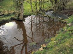 Comprehensive unpublished lists, maps and descriptions of the sinks and risings of this area have been produced by G. Burns (Reyfad Group) for the Belmore area. II - Underground karst Little cave development has been discovered and very little has been published about cave investigations in this area. No caves longer than a few metres are recorded and one small relict cave exists on the eastern flank of the mountain. Moneyouragan pot, which lies in a dry valley, is a 6m deep surface pothole in the Cherty Facies of the Dartry Limestone. Mullyard Sink Cave is 120m of small passage in cherty limestone trending southeast to a sump which has been dived for 3m and is still open. The assumed resurgence is impenetrable. III - Surface karst The only surface karst features of note in the Belmore area are the solution dolines and sinks and associated spring line, the cliffs in the Dartry Limestone in Tents townland and the knolls of mudbank limestone. The dry valley in Moneyouragan townland which runs parallel with the slope at approximately 250m amsl is the largest dry valley in the area. | |
| Importance: | |
There is very little in the area of karst geomorphological importance. The exception is Holywell Rising, a large karst spring. | |
| Interpretation: | |
I - Hydrology The presence of numerous small sinks and risings on the southern slopes of Belmore Mountain, rather than fewer larger sites, appears to be related to the lack of a single strong control in the area on which major cave development could occur. The presence of numerous fissures, the dolomitization and the Tertiary intrusion all add to the geological complexity of the unit and these seem to have restricted karstification. A fault at the eastern end of the Belmore scarp has displaced the Knockmore - Glencar contact north and has offset the line of sinks in Tents, Rahallen and Carrickmacsparrow townlands to 200m amsl from 100m amsl. The significant amount of water which resurges through a sand and boulder bedded pool at Holywell is of unknown origin, but it has been suggested by some speleologists that water from the Reyfad System could reach this side of the Tullybrack - Ballintempo upland although it has been proved that water sinking at Waterfall Sink (Reyfad System) does not resurge at Holywell. II - Surface karst Mitchell (1983) suggests that the dolomites are more easily weathered and were also extensively excavated by ice during the last glaciation because of the contrast between the relatively soft, granular nature of the dolomite and the hard, compact micrite of the Dartry Formation. This has controlled the development of the bench feature on the southern Belmore scarp slope. Moneyouragan dry valley could also be a feature related to an ice edge. The boulder clay cover on the lower slopes is a further feature of the last glaciation. | |
| Conclusions: | |
CONCLUSION The Holywell site is worthy of designation, and further hydrological tracing to discover its origin could further increase its significance. The rest of the area contains many surface karst features but none of them appear with the present information available to be of significance on a local or national scale. | |
| Notes: | |
For site specific information see; Key Site 378 - Holywell Rising Key Site 379 - Moneyouragan Pot Key Site 380 - Moneyouragan Sink Key Site 381 - Moneyouragan Cave Key Site 382 - Rahallan Sink 1 Key Site 383 - Rahallan Sink 2 Key Site 384 - Mullyard Sink. For information and reference lists on the systems and features of other karst areas within the Belmore, Ballintempo and Tullybrack Uplands see; Key Site 1159 - Boho Key Site 1160 - Reyfad-Carrickbeg Key Site 1161 - Noon's Hole-Arch Cave Key Site 1162 - Knockmore-Pollaraftra. BIOLOGICAL INTEREST No biospeleological collections have been carried out in the Belmore area. | |
| Keywords | |
|---|---|
| Minerals: | Dolomite |
| Rocks: | Chert, Dolerite, Limestone, Mudstone |
| Structures: | dyke, fault |
| Geomorph: | cave, doline, drift, dry valley, pothole, sinkhole |
| Measurements | |||||
|---|---|---|---|---|---|
| Length: | Width: | Height: | |||
| Depth: | Area: | 20 km2 | |||
| Access | |
|---|---|
| Planning: | HISTORY OF EXPLORATION In 1971 the Reyfad Group concentrated their exploration efforts for a short period on Belmore Mountain with little result. In 1979 members of the Group explored Mullyard Sink Cave and during the 1980's comprehensive surface investigation and mapping was undertaken by G. Burns of the Reyfad Group. |
| Management: | |
There are two large quarries on the southern slopes of Belmore Mountain. Mitchell (1983) describes the extensive dolomite deposits in the area and states that they are the largest potentially economic deposit of dolomite in Northern Ireland. External threats: Dumping of rubbish and infilling of dolines for land improvement in the area has degraded the karst features. There has also been some redirecting of drainage in the upland area of Carrickmacsparrow townland which has deprived sinkholes (and presumably the associated risings) of water. | |
| Threats: | Land improvement practices; dumping; quarrying. |
| Uses | |
| Potential: | Dye tracing and water chemistry research would add greatly to the limited hydrological knowledge of the Belmore - Holywell area. The potential for cave exploration in the area does not seem to be significant. Quarrying of dolomite. |
| References (28) | |||
|---|---|---|---|
| Adair, F., 1974. Notes on the distribution and behaviour of the cave spider, Meta menardi (Latr.) in Ireland (Araneae Argiopidae). Irish Naturalists Journal, vol. 18 pt. 2, pp.40-41. | |||
| Barnes, S., 1994. Preliminary Hydrological Investigation of the Area between Carnlough and Waterfoot, County Antrim, Northern Ireland. (Thesis) University of East Anglia. | |||
| Boon, M., 1977. Down to a Sunless Sea. | |||
| Brook, D., 1971. Notes on the Reyfad Area. University of Leeds Speleological Association Review, numb. 8. | |||
| Clark, S., 1975. Hull University Speleological Society Expedition to Northern Ireland 1975. Hull University Speleological Society. | |||
| Coleman, J., 1965. The Caves of Ireland. Anvil Books, Tralee. | |||
| Drew, D.et al., 1977. Caves and Karsts of Ireland. In 7th International Speleological Congress British Cave Research Association. | |||
| Fletcher, T.P., 1977. Lithostratigraphy of the Chalk (Ulster White Limestone Formation) in Northern Ireland. Report of the Institute of Geological Sciences, vol. 77/14. | |||
| Gunn, J., 1985. Water Tracing in the North Cuilcagh Karst. Irish Speleology, vol. 3 pt. 2. | |||
| Halliwell, R.A., 1970. An Elementary Study of the Cave Morphology and Seepage in the Reyfad-Pollnacrom System. Transactions of the Cave Research Group of Great Britain, vol. 12 numb. 4. | |||
| Hazleton, M., 1973. Irish Hypogean Fauna and Irish Biological Records 1856-1971. Transactions of the Cave Research Group of Great Britain, vol. 15 numb. 4. | |||
| Hopkirk, A., 1994. The Search for Bat Hibernacula in Ireland. The Leisler. Magazine of the Northern Ireland Bat Group, vol. 1994 numb. Spring. | |||
| Jameson, H.L., 1896. On the Exploration of the Caves of Enniskillen and Mitchelstown for the R.I.A. Flora and Fauna Committee. Irish Naturalists Journal, vol. 5, pp.93-100, plates 1. | |||
| Jones, G.Ll. & McKeever, M., 1987. Sediments and Palynology in Marble Arch Cave. Cave Science, vol. 14 numb. 1. | |||
| Kelly, J.G., 1989a. The late Chadian to Brigantian Geology of the Carrick-on-Shannon and Lough Allen Basins, North West Ireland. (Thesis) N.U.I. | |||
| Kelly, J.G., 1989b. Geology and Caves of Cuilcagh Mountain, Counties Fermanagh and Cavan. Irish Speleology, vol. 13. | |||
| Kelly, J.G., 1990. Reyfad Pot. Irelands Deepest (and Longest?) Descent 96. | |||
| Kelly, J.G., 1995. The Asbian Geology of Cuilcagh Mountain Area, Co's Fermanagh and Cavan, Ireland. Initiation, growth and decline of a tectonically controlled carbonate ramp. In European Dinantian Environments II. | |||
| Legg, I.C., Johnston, T.P., Mitchell, W.I. & Smith, R.A., 1995. Geology of the country around Derrygonelly and Marble Arch. Memoirs of the Geological Survey Northern Ireland, vol. Sheet 44,56,43. | |||
| Magennis, P., 1874. The Ribbon Informer. A Tale of Lough Erne. Frederick Bell and Co. | |||
| Martel, E.A., 1897. Irelande et Cavernes Anglaises. Libraire ch. Delagrave., Paris. | |||
| McKay, S., 1987. The Chemical Differentiation of Carbonate Aquifers in the Karst of North-West Ireland, with a view to predicting the type and length of cave system under Belmore Mountain. (Thesis) University of Bristol. | |||
| McKay, S., 1989. A study of Carbonate Aquifers in the Karst of North West Ireland. Irish Speleology, vol. 13. | |||
| Mitchell, W.I., 1983. High grade Dolomite deposits in the Belcoo - Boho area of County Fermanagh. (Unpublished Report) Geological Survey of Northern Ireland Open File Reports, vol. 68. | |||
| Nichols, A., 1970. Cambridge University Caving Club Expedition to Ireland, 1970. Cambridge University Caving Club. | |||
| Oswald, D.H., 1955. The Carboniferous Rocks between the Ox Mountains and Donegal Bay. Journal of the Geological Society of London, vol. 111, pp.167-186. | |||
| Sheridan, D.J.R., 1972. Upper Old Red Sandstone and Lower Carboniferous of the Slieve Beagh Syncline and its setting in the northwest Carboniferous basin, Ireland. Special Papers of the Geological Survey of Ireland, vol. 2, pp.1-120. | |||
| Williams, P.W., 1970. Limestone morphology in Ireland. In Irish Geographical Studies, pp.105-124 Queens University of Belfast. | |||
| Map(s): | A boundary has been drawn to enclose the specific area around Holywell and is marked on 1:10,000 sheet 228 and is labelled as: HW1 Holy Well. | ||
| Record type: | ESCR report | ||
| Entered by: | E M Porter | ||
| Last updated: | 23 Dec 2003 | ||
| Enlander, I., Dempster, M. & Doughty, P., 2026. Belmore, Ballintempo & Tullybrack Uplands; Belmore, County Fermanagh, site details. [In] Earth Science Conservation Review. https://www.habitas.org.uk/escr/site.php?item=1158. Accessed on 2026-11-04. |
| Previous Site | Next Site |