
| Previous Site | Next Site |
Earth Science Conservation Review
| Brown's Bay, Island Magee | Antrim |
| Site number: | 1197 | ||
| ESCC: | EF | ||
| Locality Type: | Coastal section | Status: | local interest |
| Grid Reference: | D435028 Centroid | ||
| Google maps: | 54.85281,-5.76564 | ||
| County: | Antrim | Council area: | Mid & East Antrim Borough Council |
| Period: | Tertiary, Cretaceous, Triassic | ||
| Stages: | Eocene, Palaeocene, Rhaetian, Santonian, Scythian | ||
| Lithostrat: | Antrim Lava Group, Interbasaltic Formation, Mercia Mudstone Group, Ulster White Limestone Formation | ||
| Site Description | |
|---|---|
 | |
| Highlights: | |
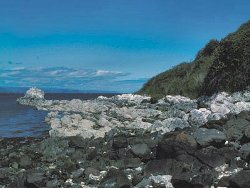
The exposures at Brown's Bay, Island Magee demonstrate the detailed structural and stratigraphic relationships between the sedimentary and igneous rocks. The main value of the site is as a teaching aid particularly for field mapping principles. | |
| Introduction: | |
The Mesozoic and Palaeogene rocks at Brown's Bay outcrop on the northern end of Island Magee, Co. Antrim. These strata were mapped by the Geological Survey of Ireland in 1867 and described by Hull (1876). Remapping of the area (GSNI, 1994) confirmed the veracity of the earlier maps. Cole et al., (1912) described the Interbasaltic Formation. | |
| Description: | |
On the eastern side of Brown's Bay, reddish brown variably calcareous mudstones (weathered to soft marls) of the Mercia Mudstone Group are exposed on the foreshore.
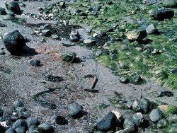 On the western side of the bay, foreshore exposures are an almost complete, 15m thick, section through the Interbasaltic Formation. 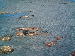 | |
| Importance: | |
The site is of importance in local geology terms illustrating stratigraphic and structural relationships between the sediments and igneous rocks, and enabling the environments of deposition to be demonstrated. | |
| Interpretation: | |
The age of the Mesozoic and Palaeogene strata at Brown's Bay has not been in doubt since they were mapped during the original geological survey. The rocks of the Mercia Mudstone Group show deposition in inland non-marine seas. They are brought into juxtaposition with much younger sediments, the chalk of the Ulster White Limestone Formation, by a major NNW trending fault, a fracture direction which defines the eastern coast of Co. Antrim. The fault is a complex structure with slivers of the Hibernian Greensands Formation and Waterloo Mudstone Formation caught up in the fault plane; such features are rarely demonstrable. The Ulster White Limestone contains fossils that indicate formation in a marine tropical environment. In places along its upper surface clay-with-flints, a probable remani‚ soil, was developed before the volcanic outpourings. The Interbasaltic Formation represents a period of sub-tropical weathering between the two main volcanic episodes of the Palaeogene of Northern Ireland. | |
| Conclusions: | |
The site is of local significance as a teaching aid. The relationships demonstrated here can be used for training in field observations and contrasted with other more continuously exposed localities. | |
| Notes: | |
For information on other Triassic sites see Key Site 1198 - Cloghfin Port, Island Magee Key Site 1199 - Collin Glen Key Site 1200 - Scrabo Hill - Triassic Key Site 1201 - Milltown Key Site 1202 - Drapersfield Quarry Key Site 1203 - Lissan Water Key Site 1204 - Curraghlane. For general information on the Triassic System in N. Ireland see Key Site 1192 - The Triassic System in N. Ireland - Introduction. | |
| Keywords | |
|---|---|
| Rocks: | Basalt, Bauxite, Limestone, Mudstone |
| Structures: | fault |
| Relations: | Lacustrine sediments, Marine sediments |
| Paleoenv: | lacustrine, tropical sea |
| Access | |
|---|---|
| Approach: | Access to the site is from the public car park and along the shore. |
| Management: | |
The only danger to the exposures would be marina and slipway development at the eastern and western sides of bay. | |
| Threats: | Marina and/or slipway development. |
| Uses | |
| Educ. Level: | Undergraduate |
| References (2) | |||
|---|---|---|---|
| Cole, G.A.J., Wilkinson, S.B., McHenry, A., Kilroe, J.R., Seymour, H.J., Moss, C.E. & Haigh, W.D., 1912. The Interbasaltic rocks (Iron Ores and Bauxites) of NE Ireland. Memoirs of the Geological Survey of Ireland. | |||
| Hull, E., 1876. The country around Antrim, Larne and Carrickfergus. Memoirs of the Geological Survey of Ireland. | |||
| Map(s): | GSNI (1994) 1:50,000 Geological Sheet 21 (Larne). | ||
| Record type: | ESCR report | ||
| Entered by: | E M Porter | ||
| Last updated: | 8 Jan 2005 | ||
| Enlander, I., Dempster, M. & Doughty, P., 2026. Brown's Bay, Island Magee, County Antrim, site details. [In] Earth Science Conservation Review. https://www.habitas.org.uk/escr/site.php?item=1197. Accessed on 2026-11-05. |
| Previous Site | Next Site |