
| Previous Site | Next Site |
Earth Science Conservation Review
| Burntollet and Tamnymore Wood | Londonderry |
| Site number: | 150 | ||
| ESCC: | EO | ||
| Locality Type: | Inland exposure, Stream section | Status: | ESCR |
| Grid Reference: | C505105 Centroid | ||
| Google maps: | 54.93998,-7.21203 | ||
| County: | Londonderry | Council area: | Derry City & Strabane District Council |
| Period: | Precambrian | ||
| Stages: | Dalradian | ||
| Lithostrat: | Ballykelly Formation | ||
| Site Description | |
|---|---|
 | |
| Highlights: | |
Burntollet and Tamnymore Wood includes extensive outcrop of the phyllitic and thin limestone units which characterise the lowermost units of the Ballykelly Formation (Upper Dalradian). At this site, it is possible to appreciate the broad lithological contrasts between the Ballykelly and the underlying Claudy Formation. The site also contains good exposure of the principle structural elements of this part of the Sperrins, in particular, the relationships between successive cleavages. | |
| Introduction: | |
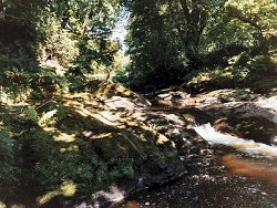
The Burntollet & Tamnymore Wood site lies within Ervey Wood Country Park and extends approximately 500m upstream from Burntollet Bridge [C503 107] along the northern side of the deeply dissected valley of the Burntollet River. Access to the site is via the Nursery at Burntollet Bridge, just off the main A6 Londonderry to Belfast Road, or along paths leading from the car park at the Country Park on Ervey Road [C510 108]. On the first edition of the one inch to one mile geological map of the area, (Sheet 18, Dungiven) (Geological Survey of Ireland, 1884) the rocks at this site were included within the general category "chloritic, talcose & micaceous schists". During the late 1960's, in the course of mapping on the Limavady map (Sheet 12, Geological Survey of Northern Ireland, 1981) rocks comparable to those at Burntollet were referred to the Ballykelly Formation which formed part of the Upper Dalradian, now referred to as the Southern Highland Group, see table below. Arthurs (1976) described the Ballykelly Formation as a series of metagreywackes and slates with occasional thin limestones and epidiorites. The occurrence of limestones at Burntollet (probably equivalent to the Barrinalt Limestone Member) and the presence, directly south of the river, of quartz psammites typical of the Claudy Formation, appears to confirm the stratigraphic position of the strata at this site close to the base of the Ballykelly Formation. TABLE TO BE ADDED Dalradian stratigraphy and ESCR sites in the northern Sperrin Mountains. | |
| Description: | |
The site contains outcrops in the bed of the Burntollet River and along the steeply eroded northern side of Ervey Glen. Together, these rocks constitute a 500m long strike section through some 50m of the lowermost strata of the Ballykelly Formation. These strata consist predominantly of mixed and interbedded grey to pale green semipelite, pelitic schist and striped psammite, occasional thin bluish grey and bluish black limestone with partially decalcified micaceous calcareous schist and massive, dark greenish-grey, feldspar-phyric crystalline metabasite. All of these outcrops are cut by a regionally significant and penetrative (S2) cleavage. This fabric dips N at 20° to 30° and, in most outcrops can be seen to strongly crenulate an earlier more steeply dipping fabric. This appears to be a pressure solution fabric or possibly a composite S0?S1 surface. It is particularly evident in semipelites and fine- grained psammitic lithologies where it is in the form of a rhythmic, millimetre-scale compositional banding (segregation?) with alternating thicker quartzo-feldspathic (white) and thinner dark micaceous (chloritewhite mica) domains. This structure imparts a distinctive striped herring bone appearance to the rock. S2 on S1S0 intersections on bedding surfaces, especially in the more phyllitic horizons, result in a well-developed cleavage lineation (L2). Throughout this site, minor co-planar folds (F2) plunge towards the east and north-east consistently verging towards the SE. The microlithons between S2 crenulation surfaces also display a consistent top towards SE sense of rotation. | |
| Importance: | |
This readily accessible site provides access to some of the best exposures of the lowermost strata of the Ballykelly Formation. At Burntollet one can view a wide range of metasedimentary lithologies together with metabasite. The site also contains good examples of structures and cleavage relationships. | |
| Interpretation: | |
The strata exposed at this site formed from poorly sorted sediments believed to have been deposited in an open marine basin environment by turbidity currents. These rocks represent a significant transition from the nearer shore more stable and shallower water environments which characterise the underlying Claudy Formation. Arthurs (1976) referred to the rocks of the Ballykelly Formation as metagreywackes. Whilst the rocks at this site certainly appear to have originated from poorly sorted clastic sediments this cannot be confirmed since all original sedimentary structures appear to have been displaced or obliterated by deformation and southwards translation. In common with all Dalradian rocks in Britain and Ireland the Ballykelly Formation, underwent regional deformation and metamorphism during the Caledonian Orogeny. Mineral assemblages in metabasites and metasedimentary lithologies typically include chlorite, epidote, actinolite and albite indicating low-grade regional metamorphism most probably under Greenschist Facies conditions. Structurally, the site now lies on the northern, upwards facing limb of the Sperrin Overfold, the major F2 structure in the Sperrin Mountains, interpreted as the south-westerly equivalent of the Lough Tay Nappe and other recumbent fold structures in the Southern Highlands of Scotland. | |
| Conclusions: | |
Burntollet and Tamnymore Wood is a geologically important site which undoubtedly merits designation. It is a site of national (Northern Ireland) significance marking the transition between two of the main geological formations (Claudy and Ballykelly) in the northern Sperrins. The site also offers some of the best opportunities available locally to study structural relationships which are key to understanding the overall structural configuration of the Sperrin Mountains. | |
| Notes: | |
For site specific information and references on other Dalradian sites in the Sperrin Mountains, Londonderry and Tyrone see the following sites: For Central and Southern Sperrin Mountains: Key Site 130 - Butterlope Glen Key Site 131 - Craig Key Site 132 - Mullaghcarbatagh Key Site 133 - Henry's Bridge, Glensass Burn Key Site 134 - Oughtboy Burn Key Site 135 - Garvagh Burn Key Site 136 - Barnes Gap Key Site 137 - Barnes Burn Key Site 138 - Golan Burn Key Site 139 - Glendarragh Burn, Glenlark Key Site 140 - Mountfield Old Quarry Key Site 141 - McNally's Burn, Broughderg For North Sperrin Mountains and Londonderry: Key Site 142 - Letterbrat Quarry Key Site 143 - Banagher Glen Quarry Key Site 144 - Strabane Quarry Key Site 145 - Glenmornan River, Artigarvan Key Site 146 - Balix Hill Key Site 147 - Drain Quarry Key Site 148 - Kildoag Quarry Key Site 149 - Loughermore Mountain Key Site 151 - Dog Leap, Limavady Key Site 152 - Kittybane Quarry Key Site 153 - Prehen Quarry Key Site 154 - Creevagh Hill Old Quarry For site specific information and references on other Dalradian sites in North-east Antrim see the following sites: Key Site 155 - Benvan Key Site 156 - Escort Port Key Site 157 - Torr Head Key Site 158 - Altmore Burn Key Site 159 - Leckpatrick Point Key Site 160 - Carnaneigh Key Site 161 - Loughan Bay Key Site 162 - Loughareema Channel Key Site 163 - Knocknacarry Bridge Key Site 164 - Cushendun Bay and Rock Port For general information on the Dalradian rocks of Northern Ireland see the following site: Key Site 124 - The Dalradian Rocks of Northern Ireland For general and site specific information on the Pre-Dalradian rocks of Northern Ireland see the following site: Key Site 123 - The Pre-Dalradian Rocks of Northern Ireland For general information and an extensive reference list on the Precambrian of Northern Ireland see the following site: Key Site 122 - An Introduction to the Precambrian of Northern Ireland | |
| Keywords | |
|---|---|
| Rocks: | Limestone, Metabasite, Pelitic rock, Psammite, Semi-pelitic rock |
| Access | |
|---|---|
| Approach: | Access to the eastern end of the site is via footpaths leading from the Car Park on Ervey Road. Access to the western part of the site is via Ness Nursery. |
| Management: | |
This is an elongate site restricted to the floor and northern slope of Ervey Glen. Parts of the eastern end of the site may fall within the limits of Ervey Wood Country Park. Access to the eastern end of the site is via footpaths leading from the Car Park on Ervey Road. Access to the western part of the site is via Ness Nursery. This part of the site, including the only riverbed outcrop lies along the perimeter of the Ness Nursery and can only be entered with the co-operation of the Nursery owners. Outcrop is relatively abundant at this site and there are no reasons to impose any special sampling or hammering restrictions. | |
| References (1) | |||
|---|---|---|---|
| Arthurs, J.W., 1976a. The geology and metalliferous mineral potential of the Sperrin Mountains area Geological Survey of Northern Ireland Special Report. | |||
| Map(s): | GSI (1884). 1:63,360 Geological Sheet 18 (Dungiven), Dublin, OS for GSI GSNI (1981). 1:50,000 Limavady, Northern Ireland Sheet 12 and part of Sheet 6, Solid, Southampton, OS for GSNI | ||
| Record type: | ESCR report | ||
| Entered by: | E M Porter | ||
| Last updated: | 8 Jan 2005 | ||
| Enlander, I., Dempster, M. & Doughty, P., 2026. Burntollet and Tamnymore Wood, County Londonderry, site details. [In] Earth Science Conservation Review. https://www.habitas.org.uk/escr/site.php?item=150. Accessed on 2026-11-05. |
| Previous Site | Next Site |