
| Previous Site | Next Site |
Earth Science Conservation Review
| Portmuck, Island Magee | Antrim |
| Site number: | 1215 | ||
| ESCC: | EC | ||
| Locality Type: | Coastal section | Status: | ASSI |
| Grid Reference: | D458023 Approximate | ||
| Google maps: | 54.84766,-5.73011 | ||
| County: | Antrim | Council area: | Mid & East Antrim Borough Council |
| Period: | Cretaceous, Jurassic | ||
| Stages: | Campanian, Cenomanian, Coniacian, Lower Jurassic, Santonian | ||
| Lithostrat: | Belfast Marls Member, Cloghfin Sponge Beds Member, Hibernian Greensands Formation, Island Magee Silts Member, Kilcoan Sands Member, Ulster White Limestone Formation, Waterloo Mudstone Formation | ||
| Site Description | |
|---|---|
 | |
| Highlights: | |
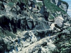
At Portmuck, Mesozoic strata from the Liassic Waterloo Mudstone Formation to the Cretaceous Glenarm Chalk Member are well exposed. These are the best exposures of the Hibernian Greensands Formation in Northern Ireland. | |
| Introduction: | |
The Portmuck site is on the east coast of Island Magee, Co. Antrim. West of Portmuck, the Mesozoic sequence from the Waterloo Mudstone Formation to the Ulster White Limestone Formation is unconformably overlain by the Palaeogene basalts and occurs as foreshore and cliff outcrops. The area was mapped and an explanatory memoir produced by Hull (1876). A new edition of the geology map was recently published (GSNI, 1994). Other studies have included those of Hancock (1961) and Fletcher (1977). | |
| Description: | |
Approximately 8m of the Waterloo Mudstone Formation is exposed as a foreshore outcrop of soft blue clays and limestones. The thin shelly limestones form a foreshore reef. The Hibernian Greensands Formation is well exposed in the cliffs to the west of Portmuck Harbour: 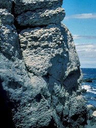 KILCOAN SANDS MEMBER Sandstone, green to brown, glauconitic, soft in places with Inoceramus bands throughout, 3.25m Sandstone, green, glauconitic, medium-grained, moderately hard with Thalassinoides burrows and harder sandstone ribs, 1.82m ISLAND MAGEE SILTSTONES MEMBER Sandstone, buff to grey, glauconitic, moderately soft, 0.50m Sandstone, grey, slightly glauconitic, hard, 0.50m Sandstone, grey, fine-grained and hard, 0.31m Sandstone, grey, soft and marl, 0.38m Sandstone, buff to grey, soft, marly, 0.75m Sandstone, grey, yellow and buff, harder in parts with apparent cross-bedding; harder patches weather to give a knobbly appearance; top bedding plane contains Thalassinoides burrows, 0.94m BELFAST MARLS MEMBER Marl, dark grey, soft, 0.31m Sandstone, dark grey, soft, marly,0.44m Sandstone, yellow to buff, hard, marly, 0.25m The Hibernian Greensands Formation is overlain by the Cloghfin Sponge Beds Member, ~1m thick which is a glauconitic chalk with sponges and weathers to give a rubbly appearance. It contains Inoceramus fragments and in places is a gritty softer glauconitic chalk. This in turn is overlain by the rest of the Ulster White Limestone Formation, 32m thick. | |
| Importance: | |
The exposures at Portmuck contain strata from the Jurassic Waterloo Mudstone Formation to the Cretaceous White Limestone Formation which is overlain by Palaeogene basalts. They include the best exposures in N. Ireland of the Hibernian Greensands Formation. They are therefore of national significance and should be conserved. | |
| Interpretation: | |
Ivimey-Cook (1975) recorded the fauna from the Waterloo Mudstone Formation as Lima gigantea, Lima terquemi and Cardinia ovalis with ammonites. The Ulster Museum collection also contains Astarte gueuxii, Cardinia hennocquii and Plagiostoma gigantea. The thick Hibernian Greensands Formation sequence lacks the Turonian Collinwell Sands Member, found in the Belfast area, and thus demonstrates a major hiatus in sedimentation. Lying just to the north of the Larne Axis, the thick sequence, especially of the Island Magee Siltstones Member, shows the importance of positive areas in influencing Cretaceous sedimentation. Reid (1971) identified two faunal divisions in the Cloghfin Sponge Beds Member with Rhizopoterion cf. tubiforme in the lower zone and Rhizopoterion cribosum in the upper zone. At Portmuck the lower zone is represented by a line of greensand cobbles so that sponges of the upper division occur almost from the base. The lowest Ulster White Limestone is flintless and appears to be pilula Zone (Reid 1971). Gonioteuthis granulata occurs from the base through the first 2m but examples from higher are Gonioteuthis quadrata. This is at variance with the section published by Fletcher (1977) which shows the basal Chalk as Galboly Chalk Member (i.e. socialis Zone). This is however very thin and is overlain by the Creggan Chalk Member of the pilula Zone. | |
| Conclusions: | |
The section at Portmuck contains the best exposures of the Hibernian Greensands Formation in N. Ireland. The sequence is typical of those in the Larne-Lough Neagh Basin and shows particularly well the importance of minor ridges and sub-basins on Cretaceous sedimentation. It is of national significance and should be conserved. | |
| Notes: | |
For general information on the Cretaceous System in N. Ireland see Key Site 1194 - The Cretaceous System in N. Ireland - Introduction. For information on other Cretaceous sites see Key Site 1207 - White Rocks - Cretaceous, Key Site 1208 - White Park Bay, Key Site 1209 - Dunnaglea-Larry Bane Bay, Key Site 1210 - Port Calliagh-Ballycastle, Key Site 1211 - Capecastle Quarry, Key Site 1212 - Garron Point-Cloghastucan, Key Site 1213 - Glenarm Quarry, Key Site 1214 - Creggan Quarry, Key Site 1216 - White Head, Key Site 1217 - Clarehill Quarry, and Key Site 1218 - Kilcoan, Island Magee. This site is also important for Mineralogy and Metallogenesis. See Key Site 538 - McIlroy’s Port to Portmuck, Island Magee. | |
| Keywords | |
|---|---|
| Rocks: | Limestone, Marl, Sand, Sandstone |
| Fossil Groups: | Ammonite, Belemnite, Sponge, Trace fossil |
| Fossil List: | Inoceramus sp. , Plagiostoma giganteum J. Sowerby, Rhizopoterion cf. tubiforme, Rhizopoterion cribosum |
| Relations: | Marine sediments |
| Measurements | |||||
|---|---|---|---|---|---|
| Length: | Width: | Height: | 40 m+ | ||
| Depth: | Area: | ||||
| Access | |
|---|---|
| Approach: | On the east coast of Island Magee. Access to the site is from the car park at Portmuck Harbour. |
| Threats: | Marina and/or slipway development |
| References (5) | |||
|---|---|---|---|
| Fletcher, T.P., 1977. Lithostratigraphy of the Chalk (Ulster White Limestone Formation) in Northern Ireland. Report of the Institute of Geological Sciences, vol. 77/14. | |||
| Hancock, J.M., 1961. The Cretaceous System in Northern Ireland. Quarterly Journal of the Geological Society of London, vol. 117, pp.11-36. | |||
| Hull, E., 1876. The country around Antrim, Larne and Carrickfergus. Memoirs of the Geological Survey of Ireland. | |||
| Ivimey-Cook, H.C., 1975. The stratigraphy of the Rhaetic and Lower Jurassic in East Antrim. Bulletins of the Geological Survey of Great Britain, numb. 50, pp.51-70. | |||
| Reid, R.E.H., 1971. The Cretaceous rocks of north-eastern Ireland. Irish Naturalists Journal, vol. 1, pp.105-129. | |||
| Map(s): | GSNI (1994) 1:50,000 Geological Sheet 21 (Larne). | ||
| Record type: | ESCR report | ||
| Entered by: | E M Porter | ||
| Enlander, I., Dempster, M. & Doughty, P., 2026. Portmuck, Island Magee, County Antrim, site details. [In] Earth Science Conservation Review. https://www.habitas.org.uk/escr/site.php?item=1215. Accessed on 2026-11-08. |
| Previous Site | Next Site |