
| Previous Site | Next Site |
Earth Science Conservation Review
| Portmuck East - Mineralogy | Antrim |
| Site number: | 539 | ||
| ESCC: | EC | ||
| Locality Type: | Coastal section | Status: | ASSI |
| Grid Reference: | D463021 Approximate | ||
| Google maps: | 54.84572,-5.72243 | ||
| County: | Antrim | Council area: | Mid & East Antrim Borough Council |
| Period: | Tertiary, Cretaceous | ||
| Lithostrat: | Antrim Lava Group, Ulster White Limestone Formation | ||
| Site Description | |
|---|---|
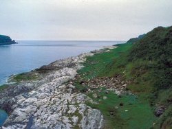 | |
| Highlights: | |
Magnetite-andradite rock at dyke margin, and a gobbinsite occurrence. | |
| Introduction: | |
The localities of interest here are (i) a 4m wide dolerite dyke through Chalk southeast of Portmuck, at the margin of which the Chalk has been contact metamorphosed with the development of massive magnetite rock containing chalcedony and andradite garnet, and (ii) amygdaloidal basalt boulders near Two-Mouthed Cave along the coastline c.100m further south, in which gobbinsite has been recorded. | |
| Description: | |
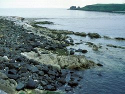 The localities are reached by either (i) a hazardous path around the seacliffs from the harbour, leading on to the storm beach, or (ii) crossing pasture fields adjacent to the farm buildings near to the car park. The latter involves crossing several fences and permission from the farmer would be required. The localities are not easily accessible and both would suffer if they attracted the attention of over-zealous mineral collectors. | |
| Importance: | |
The 4m dyke exposure near Portmuck is probably the best of its kind in Northern Ireland. Two-Mouthed Cave is the second of only two known occurrences of the rare zeolite gobbinsite in Northern Ireland. Emeleus and Preston (1969) also record the occurrence of large pink apatites and well-formed ilmenite in veins in basalt adjacent to a dyke exposed in the intertidal zone at the SE end of the Isle of Muck. This was not examined due to the hazard of crossing the tombola. | |
| Notes: | |
See also Key Site 1136 - Muck Island Tombolo, Island Magee. | |
| Keywords | |
|---|---|
| Minerals: | Andradite, Gobbinsite, Magnetite |
| Rocks: | Amydaloidal Basalt, Limestone |
| Structures: | amygdales, dyke |
| Access | |
|---|---|
| Approach: | Access is via a hazardous path around the seacliffs from the harbour, leading on to the storm beach, or crossing pasture fields adjacent to the farm buildings near to the car park. |
| Management: | |
Coastal exposures, sensitive to collection. Improve access via clifftop path. | |
| Record type: | ESCR report | Recorded by: | R. Nawaz and N.R. Moles |
| Entered by: | E M Porter | ||
| Last updated: | 07 MAY 68 | ||
| Enlander, I., Dempster, M. & Doughty, P., 2026. Portmuck East - Mineralogy, County Antrim, site details. [In] Earth Science Conservation Review. https://www.habitas.org.uk/escr/site.php?item=539. Accessed on 2026-11-08. |
| Previous Site | Next Site |