
| Previous Site | Next Site |
Earth Science Conservation Review
| McNally's Burn - Dalradian | Tyrone |
| Site number: | 141 | ||
| ESCC: | EO | ||
| Locality Type: | Stream section | Status: | ESCR |
| Grid Reference: | H689887 Centroid | ||
| Google maps: | 54.74199,-6.93018 | ||
| County: | Tyrone | Council area: | Mid Ulster District Council |
| Period: | Ordovician, Precambrian | ||
| Stages: | Arenig, Dalradian, Llanvirn | ||
| Lithostrat: | Broughderg Schists, Mullaghcarn Formation, Southern Highlands Group, Tyrone Volcanic Group | ||
| Site Description | |
|---|---|
 | |
| Highlights: | |
McNally's Burn contains some of the best and most easily accessible exposure of the thrusted contact (Omagh Fault) between the metamorphic Dalradian (Southern Highland Group) terrane of the Sperrin Mountains and the volcanic Ordovician rocks (Tyrone Volcanic Group) of County Tyrone. This river section contains exposure of the principle lithological variants within both groups together with key structural elements including imbrication and drag-folding related to the thrust. | |
| Introduction: | |
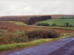
McNally's Burn is one of several streams flowing SE and draining the southern slope of Keraghbrien on the southernmost ridge of the Sperrin Mountains. This burn passes beneath the Broughderg Road at McNally's Bridge, 1.5km NEof the Chapel at Broughderg. Access to the site is along the southern bank of the Burn with the first outcrops being encountered in the stream bed about 200m upstream from McNally's Bridge. On the first edition of the one inch to one mile geological map of the area (Draperstown, Sheet 26) (Geological Survey of Ireland, 1882) the trace of the Omagh Fault was shown in more or less the same position as it was shown on the second edition of the map (Geological Survey of Northern Ireland, 1995). However, the predominantly metasedimentary (Southern Highland Group) rocks of the Sperrin Mountains were not distinguished lithologically from the metavolcanic volcanic rocks (Tyrone Volcanic Group) of the central Tyrone. Both groups of rock were included within the general category "Chloritic, Talcose & Micaceous Schists . . . Lower Silurian (Metamorphosed)". Hartley (1933, 1938), produced the first detailed litho- stratigraphic maps of the Sperrin Mountains. He referred to the uppermost stratigraphic divisions in the Dalradian, as the Mullaghcarn Schists and the Black Schists of Broughderg. On Hartley's maps, rocks from both of these divisions are shown along the northern, hanging wall, of the Omagh Fault. Arthurs (1976) modified and formalised Hartley's stratigraphy, the most significant difference being the redesignation of the Broughderg Schists as part of the Tyrone Volcanic Group rather than the Dalradian. The stratigraphy proposed by Arthurs has, with minor modifications been incorporated in the second edition of the Draperstown map (Geological Survey of Northern Ireland, 1995), see table below. TABLE TO BE ADDED Dalradian stratigraphy and ESCR sites in the southern Sperrin Mountains. | |
| Description: | |
Approximately 200m upstream from McNally's Bridge, the Burn becomes deeply incised and in both banks, greyish green and silvery talcose chlorite schist and phyllite (tuffs of the Tyrone Volcanic Group) are well exposed. These strata have a single well-developed cleavage which appears to be bedding parallel and dips at shallow angles towards the north-west. These rocks are cut by numerous quartz veins commonly in the form of early stage, foliation-parallel "sweats". Upstream, directly below the waterfall at [H671 878], the structure of the talcose and chloritic phyllites becomes more complex. A series of small-scale, northwards dipping, thrust faults is closely associated with wedges of black graphitic schist and pelite 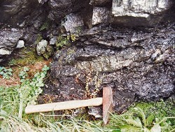 The footwall of the Omagh Thrust is exposed in the main waterfall and consists of hard, brittle, fine-grained, colour-banded chloritic tuff with epidote (Tyrone Volcanic Group). These tuffs have a highly tectonised streaky appearance and contain textural evidence of stretching and mylonitization. Upstream from the fence at the top of the waterfall, the river flattens out and meanders along a section where Dalradian rocks (Mullaghcarn Formation) are exposed in the hanging-wall of the Omagh Thrust. Along this section, outcrop is intermittent and mainly restricted to bends in the river and some over steepened and collapsed parts of the deeply incised valley. The Mullaghcarn Formation in this part of the site consists of greyish-green and orange to brown weathering chloritic and micaceous phyllites, quartz-chlorite-muscovite schist and quartz- albite psammite. There is a conspicuous strain gradient which decreases upstream away from the Omagh Thrust. Silvery grey phyllite exposed in the collapsed southern side of the valley, approximately 60m upstream of the waterfall have a platy and strongly tectonised appearance. Further upstream there is a gradual fall off in strain and the schists and psammite have more recognisable granoblastic textures. | |
| Importance: | |
This site offers access to high quality exposure in the hanging wall and footwall of the Omagh Fault. Contact relationships between Dalradian metasedimentary rocks (Southern Highland Group) and Ordovician volcanic rocks (Tyrone Volcanic Group) can be viewed at close hand. The site facilitates detailed study of deformation as it affected two distinct geological terranes (Central Highlands (Grampian) Terrane & Tyrone-Girvan Sub-Terrane, Bluck et al., 1992). McNally's Burn, therefore is potentially a site of international importance which could contribute directly to a better understanding of the deformational history of the timing of terrane accretion in Ireland and Scotland It has been suggested (Alsop et al., 1993) that the major shear zone(s) in the southern Sperrin Mountains are closely associated with late-stage movements on the Omagh Fault. In recent years, such shear zones have been found to be prospective for gold-bearing quartz veins, for example at nearby Curraghinalt [C565 862]. | |
| Interpretation: | |
The rocks in McNally's Burn belong to two contrasting geological suites which formed in very different geological environments. The strata in the southern part of the site are part of the Tyrone Volcanic Group, a sequence of basic to intermediate, arc related volcanic lavas and tuffs formed along the edge of the Iapetus Ocean about 470 Ma during Ordovician (Arenig-Llanvirn) times. The metasedimentary rocks in the northern part of the site formed originally in rapidly developing sedimentary basins which were initiated and were rapidly infilled with siliciclastic turbidite facies sediments (Mullaghcarn Formation) during Upper Dalradian times. During late-Caledonian times, these rocks, in common with Ordovician and Dalradian rocks elsewhere in the British Isles, underwent major regional deformations accompanied by metamorphism. Both the Dalradian and the Ordovician strata at this site have undergone low-grade Greenschist Facies regional metamorphism associated with the deformation described above. The Dalradian (Mullaghcarn Formation) in the vicinity of the Omagh Fault contains mineral assemblages which include chlorite, biotite, muscovite, albite with garnet (almandine) porphyroblasts augened by the composite fabric (Arthurs, 1976). This points to metamorphic conditions at the higher grade end (Quartz-albite-epidote almandine Subfacies of the Greenschist Facies) (Turner et al., 1960). The Dalradian strata were folded and as a result of major south-easterly directed translation, now lie on the northern, upwards-facing limb of the Sperrin Overfold. This major structure has long been interpreted as the south-west continuation of the Tay Nappe in Scotland (Pitcher et al., 1972). Along the southern edge of the Sperrin Mountains, the Dalradian rocks close to the Omagh Fault have a strong northerly dipping platy fabric. This is a composite structure consisting of bedding and up to three co-planar cleavages. The latest regionally significant tectonic event in this area (D3) resulted in the south-easterly directed thrusting of Dalradian rocks onto a ramp formed by the Tyrone Volcanic Group (Alsop et al., 1993). In the vicinity of the Omagh Thrust, the S3 cleavage associated with this late thrusting episode is intense and sub-parallel to bedding and the earlier S2 cleavage. The Ordovician volcanic rocks (Tyrone Volcanic Group) in the footwall of the Omagh Thrust contain a single penetrative cleavage and associated mineral lineation. These structures are concordant with S2-S3 and L2-L3 structures in the Dalradian in the immediate hanging wall of the Omagh Thrust (Alsop et al., 1993) The Ordovician rocks (Tyrone Volcanic Group) directly south of the Omagh Fault are highly deformed (mylonitised) phyllites. The mineral assemblages are dominated by chloritic and sericitic +/- epidote, indicating a lower metamorphic grade, at the lower grade end of the Greenschist Facies. | |
| Conclusions: | |
McNally's Burn is a site of national and potentially international importance offering a rare opportunity to study field relationships along a major terrane boundary. A high priority should be given to ensure that this site is conserved. | |
| Notes: | |
For site specific information and references on other Dalradian sites in the Sperrin Mountains, Londonderry and Tyrone see the following sites: For Central and Southern Sperrin Mountains: Key Site 130 - Butterlope Glen Key Site 131 - Craig Key Site 132 - Mullaghcarbatagh Key Site 133 - Henry's Bridge, Glensass Burn Key Site 134 - Oughtboy Burn Key Site 135 - Garvagh Burn Key Site 136 - Barnes Gap Key Site 137 - Barnes Burn Key Site 138 - Golan Burn Key Site 139 - Glendarragh Burn, Glenlark Key Site 140 - Mountfield Old Quarry For North Sperrin Mountains and Londonderry: Key Site 142 - Letterbrat Quarry Key Site 143 - Banagher Glen Quarry Key Site 144 - Strabane Quarry Key Site 145 - Glenmornan River, Artigarvan Key Site 146 - Balix Hill Key Site 147 - Drain Quarry Key Site 148 - Kildoag Quarry Key Site 149 - Loughermore Mountain Key Site 150 - Burntollet and Tamnymore Wood Key Site 151 - Dog Leap, Limavady Key Site 152 - Kittybane Quarry Key Site 153 - Prehen Quarry Key Site 154 - Creevagh Hill Old Quarry For site specific information and references on other Dalradian sites in North-east Antrim see the following sites: Key Site 155 - Benvan Key Site 156 - Escort Port Key Site 157 - Torr Head Key Site 158 - Altmore Burn Key Site 159 - Leckpatrick Point Key Site 160 - Carnaneigh Key Site 161 - Loughan Bay Key Site 162 - Loughareema Channel Key Site 163 - Knocknacarry Bridge Key Site 164 - Cushendun Bay and Rock Port For general information on the Dalradian rocks of Northern Ireland see the following site: Key Site 124 - The Dalradian Rocks of Northern Ireland For general and site specific information on the Pre-Dalradian rocks of Northern Ireland see the following site: Key Site 123 - The Pre-Dalradian Rocks of Northern Ireland For general information and an extensive reference list on the Precambrian of Northern Ireland see the following site: Key Site 122 - An Introduction to the Precambrian of Northern Ireland This site is also important for Structural Geology. See Key Site 647 - McNally’s Burn, Broughderg. | |
| Keywords | |
|---|---|
| Rocks: | Graphitic schist, Pelitic rock, Phyllite, Psammite, Schist, Tuff |
| Access | |
|---|---|
| Approach: | Currently this site is accessible only by crossing fenced pastureland along the southern bank of the river which is unfenced below the waterfall. |
| Management: | |
Currently this site is accessible only by crossing fenced pastureland along the southern bank of the river which is unfenced below the waterfall. At present, there do not appear to be any problems gaining access in this way. However, in view of the importance of this site, it is strongly recommended that this site is treated sensitively and that as far as possible all necessary assurances are given to the landowners to ensure continued access. The site contains many interesting outcrops but overall, exposure is limited. It is therefore recommended that hammering restrictions are considered, particularly in the area directly downstream from the waterfall where the best examples of folding and imbrication in the graphitic pelite are located. | |
| References (8) | |||
|---|---|---|---|
| Alsop, G.I. & Hutton, D.H.W., 1993. Major southeast-directed Caledonian thrusting and folding in the Dalradian rocks of mid-Ulster: implications for Caledonian tectonics and mid-crustal shear zones Geological Magazine, vol. 130 pt. 2, pp.233-244. | |||
| Arthurs, J.W., 1976a. The geology and metalliferous mineral potential of the Sperrin Mountains area Geological Survey of Northern Ireland Special Report. | |||
| Bluck, B.J., Gibbons, W. & Ingham, J.K., 1992. Terranes Memoirs of the Geological Society of London, vol. 13 In Atlas of palaeogeography and lithofacies, pp.1-4. | |||
| Hartley, J.J., 1933. The geology of north-eastern Tyrone and the adjacent parts of County Londonderry Proceedings of the Royal Irish Academy, vol. 41 pt. B. | |||
| Hartley, J.J., 1938. The Dalradian rocks of the Sperrin Mountains and adjacent areas in Northern Ireland Proceedings of the Royal Irish Academy, vol. 44 pt. B. | |||
| Nolan, J., 1884. Explanatory memoir to accompany Sheet 26 of the maps of the Geological Survey of Ireland Memoirs of the Geological Survey of Ireland. | |||
| Pitcher, W.S. & Berger, A.R., 1972. The Geology of Donegal: A study of granite emplacement and unroofing Wiley - Interscience, New York & London. | |||
| Turner & Verhoogen, 1960. Igneous and Metamorphic Petrology McGraw-Hill, New York. | |||
| Map(s): | GSI (1882). 1:63,360 Geological Sheet 26 (Draperstown), Dublin, OS for GSI GSNI (1995). 1:50,000 Draperstown, Northern Ireland Sheet 26, Solid, BGS, Keyworth, Nottingham | ||
| Record type: | ESCR report | ||
| Entered by: | E M Porter | ||
| Enlander, I., Dempster, M. & Doughty, P., 2026. McNally's Burn - Dalradian, County Tyrone, site details. [In] Earth Science Conservation Review. https://www.habitas.org.uk/escr/site.php?item=141. Accessed on 2026-11-06. |
| Previous Site | Next Site |