
| Previous Site | Next Site |
Earth Science Conservation Review
| McIlroy's Port to Portmuck - Mineralogy | Antrim |
| Site number: | 538 | ||
| ESCC: | EC | ||
| Locality Type: | Coastal section | Status: | ASSI |
| Grid Reference: | D454027 Centroid | ||
| Google maps: | 54.85137,-5.73613 | ||
| County: | Antrim | Council area: | Mid & East Antrim Borough Council |
| Period: | Tertiary | ||
| Lithostrat: | Antrim Lava Group | ||
| Site Description | |
|---|---|
 | |
| Highlights: | |
Sodalite-bearing pegmatite in picritic lava flow and unusual minerals in meta-basalt. | |
| Introduction: | |
Geological features of McIlroy's Port have been described in detail by Preston (see Key Site 640 - McIlroy’s Port, Island Magee [Igneous/Tertiary Block]).
 | |
| Description: | |
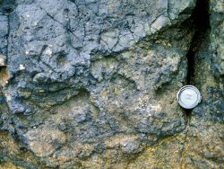
A sodalite-bearing pegmatite occurs near the base of the picritic lava flow, principally to the south of the vent. Preston notes that this is the first recorded occurrence of sodalite in Ireland.
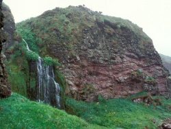
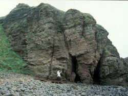
 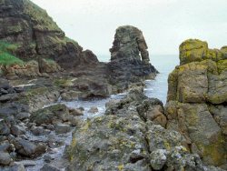 McIlroy's Port is a rather inaccessible coastline locality c.1km north of Portmuck harbour. It can be approached from Portmuck at low tide, or by descending from farm lanes to the east. Neither approach is easy, and the preferred access route would be through re-instating a clifftop path from Portmuck, from which paths could be created descending into McIlroy's Port and into the bay at the agglomerate vent (see also Key Site 539 - Coast opposite Isle of Muck, Island Magee). An attractive waterfall is located some 50m north of the vent and access between these points is via a natural tunnel near high tide level. The boulder beach at the vent locality is hazardous when wet, as the boulders are very slippery. | |
| Notes: | |
See also Key Site 640 - McIlroy's Port, Island Magee and Key Site 1215 - Portmuck, Island Magee. | |
| Keywords | |
|---|---|
| Minerals: | Natrolite, Sodalite, Titanaugite |
| Rocks: | Amydaloidal Basalt, Pegmatite, Picrite |
| Structures: | dyke, volcanic vent |
| Access | |
|---|---|
| Approach: | McIlroy's Port can be approached from Portmuck at low tide or by descending from farm lanes to the east. Neither approach is easy, and the preferred access route would be through re-instating a clifftop path from Portmuck, from which paths could be created descending into McIlroy's Port and into the bay at the agglomerate vent. |
| Management: | |
Coastal cliffs accessible only at low tides. Improve access via clifftop path. | |
| Record type: | ESCR report | Recorded by: | R. Nawaz and N.R. Moles |
| Entered by: | E M Porter | ||
| Last updated: | 07 MAY 68 | ||
| Enlander, I., Dempster, M. & Doughty, P., 2026. McIlroy's Port to Portmuck - Mineralogy, County Antrim, site details. [In] Earth Science Conservation Review. https://www.habitas.org.uk/escr/site.php?item=538. Accessed on 2026-11-06. |
| Previous Site | Next Site |