
| Previous Site | Next Site |
Earth Science Conservation Review
| Barony Glen | Londonderry |
| Site number: | 301 | File Number: | C70 |
| ESCC: | EO | ||
| Locality Type: | River bank, Stream section | Status: | local interest |
| Grid Reference: | C732016 1 km square | ||
| Google maps: | 54.85724,-6.86018 | ||
| County: | Londonderry | Council area: | Mid Ulster District Council |
| Period: | Carboniferous | ||
| Stages: | Tournasian | ||
| Lithostrat: | Altagoan Formation, Drumard Member, Tyrone Group | ||
| Site Description | |
|---|---|
 | |
| Highlights: | |
The deeply incised valley of Barony Glen exposes a virtually continuous section through the Drumard Member of the Altagoan Formation. | |
| Description: | |
Exposures of the Drumard Member occur in an almost continuous section over some 320m of stream bed and in fresh and clean bank sections in Barony Glen. The stream course is steeply inclined falling from an altitude of about 460m, at the base of the overlying Palaeogene (Tertiary) basalt lavas that cap White Mountain and Mullaghmore, to an altitude of 360m just east of Barony Bridge where the last exposure occurs.
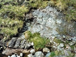 Exposures consist of a wide variety of lithologies with purple- brown shades dominating the rocks, although green to pale grey and purple-red colours occur sporadically. Evidence of pedogenesis (soil formation) abound, in particular the formation of carbonate nodules and discrete pedogenic limestone bands. 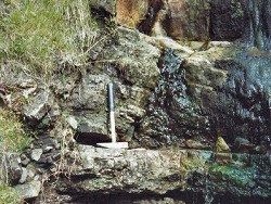 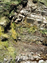 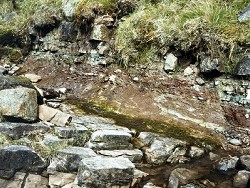 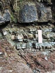 | |
| Notes: | |
For information on other sites in Subarea-12 see Key Site 1185 - Subarea-12; Draperstown-Glenshane Pass-Limavady. | |
| Keywords | |
|---|---|
| Rocks: | Limestone, Mudstone, Sand, Sandstone, Siltstone |
| Relations: | Fluvial sediments |
| Paleoenv: | alluvial plain |
| Measurements | |||||
|---|---|---|---|---|---|
| Length: | 320 m | Width: | Height: | ||
| Depth: | Area: | ||||
| Map(s): | GSNI (1981) 1:50,000 Solid Geology of Sheet 12 (Limavady); GSNI (1995) 1:50,000 Solid Geology of Sheet 26 (Draperstown). | ||
| Record type: | ESCR report | ||
| Entered by: | Doughty, P.J. | ||
| Last updated: | 23 Dec 2003 | ||
| Enlander, I., Dempster, M. & Doughty, P., 2026. Barony Glen, County Londonderry, site details. [In] Earth Science Conservation Review. https://www.habitas.org.uk/escr/site.php?item=301. Accessed on 2026-11-05. |
| Previous Site | Next Site |