
| Previous Site | Next Site |
Earth Science Conservation Review
| Tullyhona, Brookfield and Trien; Whiskey Holes | Fermanagh |
| Site number: | 336 | File Number: | H13 |
| ESCC: | IC | ||
| Locality Type: | Cave, Sinkhole | Status: | ASSI |
| Grid Reference: | H15453332,H15543332 | ||
| Google maps: | 54.24881,-7.76373 | ||
| County: | Fermanagh | Council area: | Fermanagh & Omagh District Council |
| Period: | Quaternary | ||
| Stages: | Holocene | ||
| Site Description | |
|---|---|
 | |
| Description: | |
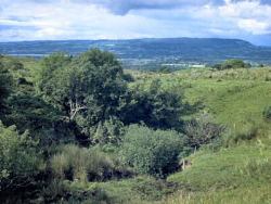
The main point input to Tullyhona Rising Cave is derived from two streams draining the northern slopes of Trien Mountain. These streams sink in two distinct groups of sinkholes; Dick's Sinks to the east which feed the stream in Up The Junction Passage, and Whiskey Holes to the west which feed the stream in Oxbow Inlet Series. The stream sinking at Whiskey Holes enters the cave at the upstream end of Oxbow Inlet and follows approximately 150m of predominantly joint controlled passage. | |
| Notes: | |
Whiskey Holes is a feature of the Tullyhona Rising Cave system located at the eastern end of the Marlbank area, in the Marlbank- Cuilcagh Mountain Region. For general information on the systems and features of this area, including this one, and a reference list, see site description 'Marlbank-Cuilcagh Mountain Region; Tullyhona, Brookfield and Trien'. | |
| Keywords | |
|---|---|
| Rocks: | Limestone |
| Structures: | joints |
| Geomorph: | cave, clastic sediments, sinkhole |
| Measurements | |||||
|---|---|---|---|---|---|
| Length: | 150 m | Width: | Height: | ||
| Depth: | Area: | ||||
| Record type: | ESCR report | ||
| Entered by: | Doughty, P.J. | ||
| Last updated: | 24 Dec 2003 | ||
| Enlander, I., Dempster, M. & Doughty, P., 2026. Tullyhona, Brookfield and Trien; Whiskey Holes, County Fermanagh, site details. [In] Earth Science Conservation Review. https://www.habitas.org.uk/escr/site.php?item=336. Accessed on 2026-11-08. |
| Previous Site | Next Site |