
| Previous Site | Next Site |
Earth Science Conservation Review
| Carrickmore Blister | Antrim |
| Site number: | 86 | File Number: | D14 |
| ESCC: | EC | ||
| Locality Type: | Coastal section | Status: | ASSI |
| Grid Reference: | D16404285 Centroid | ||
| Google maps: | 55.21896,-6.17104 | ||
| County: | Antrim | Council area: | Causeway Coast & Glens Borough Council |
| Period: | Tertiary, Carboniferous | ||
| Stages: | Carboniferous Undifferentiated, Tertiary Undifferentiated | ||
| Lithostrat: | Lower Carboniferous | ||
| Site Description | |
|---|---|
 | |
| Highlights: | |
A small dolerite intrusion into Carboniferous fireclay effected a high temperature thermal metamorphism of the country rock. | |
| Introduction: | |
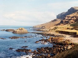
The 'Carrickmore dyke' is described in detail in Wilson (1966). This irregular intrusion shows intense thermal metamorphism of Lower Carboniferous shales and must be connected to the three offshore stacks of dolerite which lie on the same trend. | |
| Description: | |
Wilson (1966) describes a dolerite dyke which crosses the foreshore S of Carrickmore, and small offshore dolerite intrusions, W of Benmore/Fair Head. The dyke appears to be part of a somewhat irregular fault intrusion, 2.5-4.5 m wide and near vertical in its disposition. There is no sign of this dyke in the mainland cliff to the south along the line of the fault but to the north the dyke is in line with the offshore stacks of dolerite which show vertical structures along their eastern margins.
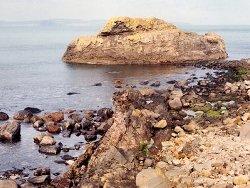 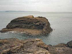 The dyke-like member of these intrusions cross cuts Carboniferous shales/fireclays which are baked to porcellanite for several metres on either side. Along the western contact the gently dipping country rock is dragged up parallel to the dyke wall. 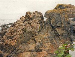 The dolerite of the Carrickmore blister effects a similar pyrometamorphism. The dolerite in the wall and roof region of the laccolith fingers out along the bedding planes of the country rock 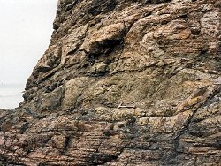 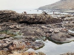 | |
| Importance: | |
An unusual and well exposed example of a high temperature magma effecting a pyrothermal metamorphism of aluminous country rock. Mullite especially, together with cordierite, spinel, and corundum characterise the baked rocks. | |
| Interpretation: | |
The intensity of the thermal alteration at the margin of this dolerite intrusion is in marked contrast to that associated with other dolerite dykes of similar or greater width which invade the Carboniferous shales and fireclays. For this reason Wright (1924) suggested it might be a feeder; there are many sill intrusions at a higher level within the Carboniferous strata which it could have fed. Agrell and Langley (1958) comment briefly on the mineralogy of the hornfelses which contain fine-grained mullite and cordierite and develop plagioclase, spinel and corundum where they are modified by the dolerite magma, i.e. in the reaction rims around the porcellanite xenoliths. The Carrickmore locality is quoted by them as further evidence for the low-pressure/high-temperature origin of mullite which differs in composition from sillimanite only by one oxygen atom in a unit cell of 20 oxygens. Porcellanite occurs at a number of high temperature dolerite contacts throughout the Province; in some instances it is produced from lateritic clays, as at Tievebulliagh, in others from fireclays, shales and calcareous shale from Carboniferous and Liassic formations; in many instances the country rock is softened or partially melted by the heat of the intrusion and its subsequent cooling leads to a very fine-grained hornfels. | |
| Conclusions: | |
Well worth conserving as a teaching locality, as a site for further research, and for the unique occurrence of a small laccolithic intrusion into Carboniferous shales. | |
| Notes: | |
In the past mine refuse was dumped above the shore but marine erosion has swept the dyke outcrop clean. | |
| Keywords | |
|---|---|
| Minerals: | Cordierite, Corundum, Mullite, Spinel |
| Rocks: | Clay, Dolerite, Fireclay, Porcellanite, Shale |
| Structures: | dyke, laccolith |
| Relations: | Intrusion |
| Measurements | |||||
|---|---|---|---|---|---|
| Length: | Width: | 2.5-4.5 m | Height: | ||
| Depth: | Area: | ||||
| Access | |
|---|---|
| Approach: | Access is restricted to low tide. A carpark is situated at Colliery Bay. A path continues E from here to Carrickmore, 1.5 km from the carpark. |
| Management: | |
Access is restricted to low water, especially for the large stack; this should help conserve the locality from oversampling. | |
| Threats: | Oversampling, possibly. |
| References (4) | |||
|---|---|---|---|
| Agrell, S.O., & Langley, J.M., 1958. The Dolerite Plug at Tievebulliagh near Cushendall, Co. Antrim. Proceedings of the Royal Irish Academy, vol. 59B, pp.93-127. | |||
| Emeleus, C.H. & Preston, J., 1969. Field excursion guide to the Tertiary volcanic rocks of Ireland., pp.70 Queen's University, Belfast. | |||
| Wilson, H.E. & Robbie, J.A., 1966. Geology of the country around Ballycastle. Memoirs of the Geological Survey Northern Ireland. | |||
| Wright, W.B., 1924. The Geology of the Ballycastle Coalfield. Memoirs of the Geological Survey of Ireland. | |||
| Map(s): | For site location see the 1:50,000 O.S. Sheet 5 (Ballycastle). Geological details on a scale of 6' to a mile are given by the GSNI; a copy of which is reproduced as Fig. 6, Emeleus & Preston (1969). | ||
| Record type: | Environment Serv. GIS, ESCR report, J. Preston l | ||
| Entered by: | Hamilton, M.J. | ||
| Last updated: | 8 Jan 2005 | ||
| Enlander, I., Dempster, M. & Doughty, P., 2026. Carrickmore Blister, County Antrim, site details. [In] Earth Science Conservation Review. https://www.habitas.org.uk/escr/site.php?item=86. Accessed on 2026-11-06. |
| Previous Site | Next Site |