
| Previous Site | Next Site |
Earth Science Conservation Review
| Mournes - Rocky Mountain | Down |
| Site number: | 1113 | ||
| ESCC: | EO | ||
| Locality Type: | Crag, Crags | Status: | ASSI |
| Grid Reference: | J234258 Centroid | ||
| Google maps: | 54.16684,-6.11058 | ||
| County: | Down | Council area: | Newry, Mourne & Down District Council |
| Period: | Tertiary | ||
| Stages: | Eocene | ||
| Lithostrat: | Granite | ||
| Site Description | |
|---|---|
 | |
| Highlights: | |
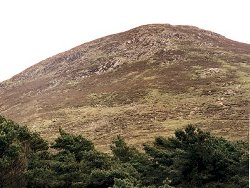
The roof contact of granite G5 against granite G4, the two ring-dyke intrusions which outcrop in the Western Mourne Mountains, is well exposed due east and south of the summit of Rocky Mountain. | |
| Introduction: | |
The granite of the Western Mourne Mountains was mapped in detail by Emeleus (1955) at J.E.Richey's suggestion. Two granites, G4 and G5, were recognised as low domes at their present level of erosion. The earlier/outer G4 intrudes Silurian grits and slates with little distubance of their disposition; the later G5 granite underlies G4 and only makes contact with the country rock to the south of Rostrevor Mountain. | |
| Description: | |
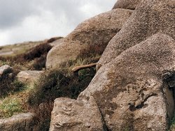
The granite G4, away from its outer margin, is typically a medium- grained, non-porphyritic rock with a characteristic purple or pinkish tint to its potash feldspar component. G5, by contrast, is a finer- grained, non-porphyritic rock; it contains numerous small drusy cavities, and has a distinctive blue-grey colour which weathers to a cream or buff tint. The contact between these two granites is well exposed.
 | |
| Importance: | |
One of many sites within the Western Mourne Mountains where the structural relationship between the two granite intrusions can be observed. Probably the best site because the actual contact can be followed continuously across natural outcrop. | |
| Interpretation: | |
The two granites are considered to be ring-dyke intrusions, as are the three granites of the Eastern Mourne Mountains, but of later age following a shift of magmatic activity to the west. At the present level of erosion, only the laccolithic tops to these ring-dykes are exposed. Volatiles trapped in the congealing G5 below a roof of G4 could have produced the drusy cavities and pegmatitic patches. | |
| Conclusions: | |
This site at Rocky Mountain offers good and continuous exposure, is reasonably accessible from the road, and yet sufficiently removed from it to ensure its protection from oversampling or quarrying. | |
| Notes: | |
For Mourne Granites general information and reference list see; Key Site 1129 - The Granites - Overview. For general information on the cone-sheet intrusions associated with the Mourne Granites, and the Mourne Mountain dyke swarm, see; Key Site 1131 - Cone-sheet and Dyke Swarm - Overview. | |
| Keywords | |
|---|---|
| Rocks: | Granite |
| Structures: | drusy, ring-dyke |
| Relations: | Contact, Intrusion |
| NonGeol: | Sheep farming |
| Access | |
|---|---|
| Approach: | Access to Rocky Mountain can be made from the road via the track to the reservoir. |
| Threats: | Oversampling by visiting geologists is probably the only hazard which could deface the site. |
| Map(s): | The site is clearly shown on Fig.1 of Emeleus (1955). | ||
| Record type: | ESCR report | ||
| Entered by: | E M Porter | ||
| Enlander, I., Dempster, M. & Doughty, P., 2026. Mournes - Rocky Mountain, County Down, site details. [In] Earth Science Conservation Review. https://www.habitas.org.uk/escr/site.php?item=1113. Accessed on 2026-11-06. |
| Previous Site | Next Site |